Area Overview for PO21 5JE
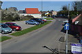
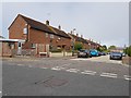
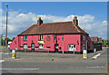
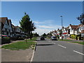
Photos of PO21 5JE


Area Information
Living in PO21 5JE offers a quiet residential life within a defined postcode area covering a small residential cluster in England. The population here stands at 1,486 occupants, creating a tightly knit neighbourhood distinct from larger urban centres. You will find a settled community where daily life revolves around stability and local familiarity. The area is characterised by its compact nature, limiting traffic noise and preserving a peaceful atmosphere for those seeking a retreat from major cities. Residents benefit from proximity to notable transport links like Bognor Regis Railway Station and Chichester Railway Station, yet the immediate surroundings remain secluded. This specific postcode represents a slice of life where the pace is slower and the focus remains on local amenities and home comfort. The demographic profile suggests a mature population, meaning you are likely to see neighbours who value consistency and traditional community structures. For potential homebuyers, the sheer size of this cluster means you will not be competing in a vast open market but rather looking at a focused selection of properties. Understanding this limited scale helps set realistic expectations about variety and term value. The area does not offer the breadth of a large town, but it provides the intimacy of a village. You can enjoy the peace of mind that comes from knowing your immediate environment without distractions. The location serves as a solid base for those prioritising tranquility over urban density.
- Area Type
- Postcode
- Area Size
- Not available
- Population
- 1486
- Population Density
- 5949 people/km²
The property market in PO21 5JE is defined by stability rather than rapid change or high volatility. Houses remain the predominant accommodation type, meaning you will primarily encounter detached, semi-detached, or terraced房的 suited for families. The home ownership percentage stands at 67%, which signals that this postcode operates largely as an owner-occupied area rather than a rental hotspot. This statistic implies that most sellers are motivated by life changes such as downsizing, moving close to children, or retiring, rather than landlords selling portfolios. When you consider buying homes in PO21 5JE, you are entering a market where properties have likely been in the same families for extended periods. The density of owner occupancy often correlates with well-maintained exteriors and gardens, as owners are directly invested in their surroundings. With only 1,486 residents across this small cluster, the available stock is naturally limited compared to larger towns. This scarcity can create a niche environment where finding the right layout requires patience but offers less competition from speculative investors. The prevalence of houses suggests that if you value private gardens or garage space, your requirements are well-met here. The low churn rate indicated by high ownership means you might find sellers who are ready to negotiate based on genuine life transitions. Buyers should expect a market driven by local needs and community ties rather than external investment pressures. The data confirms a traditional, settled housing stock that appeals to those seeking permanence.
House Prices in PO21 5JE
No properties found in this postcode.
Energy Efficiency in PO21 5JE
Your daily lifestyle in PO21 5JE benefits from a cluster of practical amenities located within practical reach. For your shopping needs, five retail outlets are nearby, including Tesco Bognor, Asda Bognor, and The Southern Co-operative Co. These supermarkets ensure you can stock up on groceries and household essentials without needing to travel far. Transport options are equally accessible, with five rail stations serving the immediate region. You will find Bognor Regis Railway Station, Barnham Railway Station, and Chichester Railway Station all within a convenient commute time. These stations provide direct links to faster networks if you need to reach larger cities. If you require private air travel, Chichester/Goodwood Airport is available one point away for your convenience. This combination of coast, air, and rail connectivity places you in a prime logistical position for both leisure and business. You can enjoy a beach morning and a business meeting in the same day with such varied options. The presence of multiple major retailers means you do not suffer from a lack of choice in daily necessities. Dining or casual shopping rounds trip times are short, preserving your evening energy. The mix of high-street and local convenience stores supports a balanced routine where large-scale shopping and quick errands coexist effortlessly. This infrastructure supports a versatile lifestyle that balances suburban convenience with regional access.
Amenities
Schools
| Rank | School | Type | Entry gender | Ages |
|---|
Explore more schools in this area
Go to Schools tabDemographics
The community profile for PO21 5JE reflects a mature society where the median age sits at 47 years. The most common age range consists of adults between 30 and 64 years, indicating a neighbourhood dominated by middle-aged individuals and families rather than single young professionals or elderly retirees. This demographic distribution influences local demands, with a focus on family spaces rather than starter homes for singles. Home ownership levels are high, with 67% of households responsible for their own property. This statistic confirms that the area is established by those who have stayed put or settled long-term rather than young tenants looking for short leases. Houses form the predominant accommodation type, aligning perfectly with the adult population seeking space and stability. The predominant ethnic group is White, which points to a fairly uniform cultural background within this specific cluster. These facts combine to create an environment where traditions likely run deep and neighbours know each other well. A 67% ownership rate in a sea of houses means fewer people are moving frequently, leading to stronger social bonds. You can expect a demographic that values established routines and perhaps has roots in the region for several decades. The lack of significant youth or elderly extremes suggests a balanced, steady community without the pressures of major demographic shifts. This stability makes the area attractive to those who want a predictable environment for raising children or enjoying retirement. The data shows a clear picture of a neighbourhood built for established households.
Household Size
Accommodation Type
Tenure
Ethnic Group
Religion
Household Composition
Age
Household Deprivation
NS-SEC
Explore more demographic insights in this area
Go to Demographics tabPlanning
Planning Constraints
- Flood RiskPremium
- Ramsar Wetland SitesPremium
- Area of Outstanding Natural BeautyPremium
- Protected Nature ReservePremium
- Protected WoodlandPremium