Area Overview for PO21 4UW
Photos of PO21 4UW
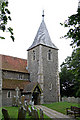
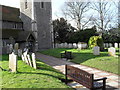
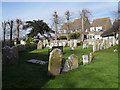
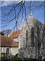
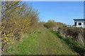
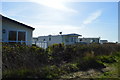
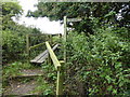
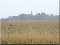
73 photos from this area
Area Information
Key information about the PO21 4UW including its size, population, and administrative classification.
- Area Type
- Postcode
- Area Size
- 1.0 hectares
- Population
- 1544
- Population Density
- 1398 people/km²
House Prices in PO21 4UW
11
Properties
£371,714
Average Sold Price
£245,000
Lowest Price
£625,000
Highest Price
Showing 11 properties
| Address | Type | Beds | Baths | Last Sale Price | Last Sale Date | |
|---|---|---|---|---|---|---|
| 51 Sea Lane, Pagham, PO21 4UW | Bungalow | 4 | 3 | £625,000 | Nov 2024 | |
| 43 Sea Lane, Pagham, PO21 4UW | Detached | 4 | 1 | £503,000 | Mar 2021 | |
| 41 Sea Lane, Pagham, PO21 4UW | Bungalow | 4 | - | £340,000 | Jul 2015 | |
| 39 Sea Lane, Pagham, PO21 4UW | Detached | - | - | £280,000 | Sep 2006 | |
| 53 Sea Lane, Pagham, PO21 4UW | Detached | - | - | £340,000 | Sep 2006 | |
| 35 Sea Lane, Pagham, PO21 4UW | Detached | - | - | £269,000 | Dec 2005 | |
| 49 Sea Lane, Pagham, PO21 4UW | Bungalow | - | - | £245,000 | Oct 2003 | |
| Heatherleigh, 55 Sea Lane, Pagham, PO21 4UW | Bungalow | 3 | 1 | - | - | |
| 37 Sea Lane, Pagham, PO21 4UW | Detached | - | - | - | - | |
| 47 Sea Lane, Pagham, PO21 4UW | Bungalow | - | - | - | - |
Page 1 of 2
Energy Efficiency in PO21 4UW
Amenities
Schools
| Rank | School | Type | Entry gender | Ages |
|---|
Explore more schools in this area
Go to Schools tabDemographics
Household Size
Two person
most common
Accommodation Type
Houses
most common
Tenure
86
majority
Ethnic Group
White
most common
Religion
N/A
most common
Household Composition
N/A
most common
Age
47
median
Adults (30-64 years)
most common
Household Deprivation
N/A
with no deprivation
NS-SEC
30
in Lower managerial occupations
Explore more demographic insights in this area
Go to Demographics tabPlanning
Planning Constraints
- Flood RiskPremium
- Ramsar Wetland SitesPremium
- Area of Outstanding Natural BeautyPremium
- Protected Nature ReservePremium
- Protected WoodlandPremium