Area Overview for PO21 3RE
Photos of PO21 3RE
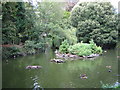

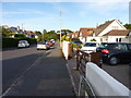
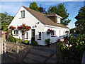
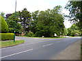
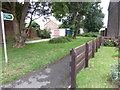
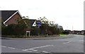
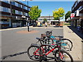
39 photos from this area
Area Information
Key information about the PO21 3RE including its size, population, and administrative classification.
- Area Type
- Postcode
- Area Size
- 2.2 hectares
- Population
- 1698
- Population Density
- 3151 people/km²
House Prices in PO21 3RE
47
Properties
£252,778
Average Sold Price
£58,000
Lowest Price
£467,500
Highest Price
Showing 47 properties
| Address | Type | Beds | Baths | Last Sale Price | Last Sale Date | |
|---|---|---|---|---|---|---|
| 77 Westminster Drive, Aldwick, PO21 3RE | Terraced | 3 | 1 | £220,000 | Dec 2024 | |
| 85 Westminster Drive, Aldwick, PO21 3RE | Terraced | 3 | 1 | £323,000 | Feb 2024 | |
| 61 Westminster Drive, Aldwick, PO21 3RE | Terraced | 3 | 1 | £295,000 | Dec 2023 | |
| 65 Westminster Drive, Aldwick, PO21 3RE | Terraced | 3 | 1 | £318,000 | Aug 2023 | |
| 43 Westminster Drive, Aldwick, PO21 3RE | Bungalow | 3 | 1 | £435,000 | Sep 2022 | |
| 81 Westminster Drive, Aldwick, PO21 3RE | Terraced | 3 | 1 | £300,000 | Jun 2022 | |
| 27 Westminster Drive, Aldwick, PO21 3RE | Bungalow | 3 | 1 | £450,000 | Feb 2022 | |
| 55 Westminster Drive, Aldwick, PO21 3RE | Terraced | 3 | 1 | £285,000 | Jun 2021 | |
| 32 Westminster Drive, Aldwick, PO21 3RE | Bungalow | - | - | £336,000 | Jun 2021 | |
| 75 Westminster Drive, Aldwick, PO21 3RE | Terraced | 3 | 1 | £285,000 | Apr 2021 |
Page 1 of 5
Energy Efficiency in PO21 3RE
Amenities
Schools
| Rank | School | Type | Entry gender | Ages |
|---|
Explore more schools in this area
Go to Schools tabDemographics
Household Size
Two person
most common
Accommodation Type
Houses
most common
Tenure
89
majority
Ethnic Group
White
most common
Religion
N/A
most common
Household Composition
N/A
most common
Age
47
median
Elderly (65+ years)
most common
Household Deprivation
N/A
with no deprivation
NS-SEC
36
in Lower managerial occupations
Explore more demographic insights in this area
Go to Demographics tabPlanning
Planning Constraints
- Flood RiskPremium
- Ramsar Wetland SitesPremium
- Area of Outstanding Natural BeautyPremium
- Protected Nature ReservePremium
- Protected WoodlandPremium