Area Overview for PO21 3LP
Photos of PO21 3LP
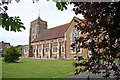
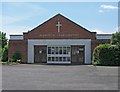
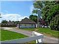
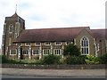
64 photos from this area
Area Information
Key information about the PO21 3LP including its size, population, and administrative classification.
- Area Type
- Postcode
- Area Size
- 1.4 hectares
- Population
- 1713
- Population Density
- 3739 people/km²
House Prices in PO21 3LP
22
Properties
£272,361
Average Sold Price
£82,000
Lowest Price
£520,000
Highest Price
Showing 22 properties
| Address | Type | Beds | Baths | Last Sale Price | Last Sale Date | |
|---|---|---|---|---|---|---|
| 54 Carlton Avenue, Aldwick, PO21 3LP | Bungalow | 2 | 1 | £325,000 | Sep 2024 | |
| 38 Carlton Avenue, Aldwick, PO21 3LP | Chalet | 3 | 2 | £520,000 | Apr 2024 | |
| 53 Carlton Avenue, Aldwick, PO21 3LP | Semi-detached | 3 | 1 | £386,500 | Jul 2023 | |
| 50 Carlton Avenue, Aldwick, PO21 3LP | Semi-detached | 2 | 1 | £325,000 | Oct 2022 | |
| 49 Carlton Avenue, Aldwick, PO21 3LP | Detached | 4 | 2 | £321,500 | Dec 2019 | |
| 65 Carlton Avenue, Aldwick, PO21 3LP | Bungalow | 2 | 1 | £260,000 | Oct 2019 | |
| 45 Carlton Avenue, Aldwick, PO21 3LP | Bungalow | 2 | 1 | £285,000 | Oct 2019 | |
| 51 Carlton Avenue, Aldwick, PO21 3LP | Bungalow | - | - | £275,000 | Apr 2019 | |
| 59 Carlton Avenue, Aldwick, PO21 3LP | Bungalow | 4 | 2 | £260,000 | Nov 2018 | |
| 58 Carlton Avenue, Aldwick, PO21 3LP | Bungalow | 3 | 1 | £380,000 | Jul 2018 |
Page 1 of 3
Energy Efficiency in PO21 3LP
Amenities
Schools
| Rank | School | Type | Entry gender | Ages |
|---|
Explore more schools in this area
Go to Schools tabDemographics
Household Size
Two person
most common
Accommodation Type
Houses
most common
Tenure
77
majority
Ethnic Group
White
most common
Religion
N/A
most common
Household Composition
N/A
most common
Age
47
median
Adults (30-64 years)
most common
Household Deprivation
N/A
with no deprivation
NS-SEC
30
in Lower managerial occupations
Explore more demographic insights in this area
Go to Demographics tabPlanning
Planning Constraints
- Flood RiskPremium
- Ramsar Wetland SitesPremium
- Area of Outstanding Natural BeautyPremium
- Protected Nature ReservePremium
- Protected WoodlandPremium