Area Overview for PO21 3DD
Photos of PO21 3DD


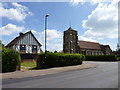
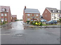
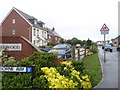
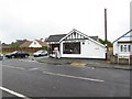
64 photos from this area
Area Information
Key information about the PO21 3DD including its size, population, and administrative classification.
- Area Type
- Postcode
- Area Size
- 7473 m²
- Population
- 1698
- Population Density
- 3151 people/km²
House Prices in PO21 3DD
7
Properties
£360,286
Average Sold Price
£162,000
Lowest Price
£500,000
Highest Price
Showing 7 properties
| Address | Type | Beds | Baths | Last Sale Price | Last Sale Date | |
|---|---|---|---|---|---|---|
| 53 Gossamer Lane, Aldwick, PO21 3DD | Bungalow | 3 | 2 | £500,000 | Mar 2021 | |
| 57 Gossamer Lane, Aldwick, PO21 3DD | Bungalow | 2 | - | £360,000 | Aug 2019 | |
| 59 Gossamer Lane, Aldwick, PO21 3DD | Bungalow | 2 | 1 | £360,000 | Jul 2018 | |
| 47 Gossamer Lane, Aldwick, PO21 3DD | Detached | 3 | 1 | £445,000 | May 2018 | |
| 45 Gossamer Lane, Aldwick, PO21 3DD | Bungalow | - | - | £355,000 | Feb 2016 | |
| 51 Gossamer Lane, Aldwick, PO21 3DD | Bungalow | - | - | £340,000 | Sep 2005 | |
| 49 Gossamer Lane, Aldwick, PO21 3DD | Detached | - | - | £162,000 | Feb 2000 |
Energy Efficiency in PO21 3DD
Amenities
Schools
| Rank | School | Type | Entry gender | Ages |
|---|
Explore more schools in this area
Go to Schools tabDemographics
Household Size
Two person
most common
Accommodation Type
Houses
most common
Tenure
89
majority
Ethnic Group
White
most common
Religion
N/A
most common
Household Composition
N/A
most common
Age
47
median
Elderly (65+ years)
most common
Household Deprivation
N/A
with no deprivation
NS-SEC
36
in Lower managerial occupations
Explore more demographic insights in this area
Go to Demographics tabPlanning
Planning Constraints
- Flood RiskPremium
- Ramsar Wetland SitesPremium
- Area of Outstanding Natural BeautyPremium
- Protected Nature ReservePremium
- Protected WoodlandPremium