Area Overview for PO21 1LX
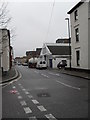
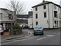
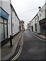
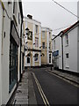
Photos of PO21 1LX


Area Information
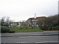
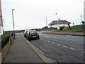
Living in PO21 1LX means residing within a tightly defined residential cluster covering just 2.9 hectares. This postcode represents a small pocket of England where over 1,000 people call home. You are part of a neighbourhood with a population of 1,095, creating a compact community where proximity to neighbours is immediate. The area sits at a population density of 37,119 people per square kilometre, indicating a high concentration of homes in a very small footprint. This density defines daily life, with residences situated close together rather than spread across a wide landscape. The location functions as a specific residential hub rather than a sprawling district. You should expect a lived-in environment where footpaths and local streets form the primary network for social interaction. The area's structure supports a tight-knit social fabric built around shared proximity. When you consider homes in PO21 1LX, you are looking at a micro-community where logistics and convenience play a central role in how you navigate your daily routine. The small size of the area means that local issues or events impact the entire vicinity quickly.
- Area Type
- Postcode
- Area Size
- 2.9 hectares
- Population
- 1095
- Population Density
- 1984 people/km²
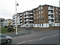
The housing stock in PO21 1LX is defined by a specific tenure split and accommodation style. With home ownership at 54%, the market is balanced between owners and renters rather than dominated by one group. This balance suggests a mix of existing families who have settled in and younger professionals or students seeking rental options. Flats serve as the predominant accommodation type, which means the physical landscape consists largely of multi-unit buildings rather than detached houses. Buyers looking for homes in PO21 1LX should prioritise second-floor units or ground-floor flats if they require ease of access. The small area size of 2.9 hectares means inventory is naturally limited, with few new build opportunities likely outside the immediate cluster. This scarcity reinforces the value of existing properties, as supply cannot easily expand to meet demand. You will find a market driven by available stock within this constrained geographic boundary. The predominance of flats appeals to those seeking lower maintenance or shared facilities, while the 54% ownership rate maintains traditional community investment values.
House Prices in PO21 1LX
Showing 53 properties
Energy Efficiency in PO21 1LX
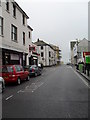
Daily life in PO21 1LX benefits from immediate access to major retail chains and rail links. You can visit Iceland Bognor, Morrisons Bognor, or Tesco Bognor Regis for groceries and household essentials without travelling far. These three supermarkets represent the primary retail anchors within practical reach of your doorstep. For commuters, rail connectivity is strong with five stations nearby including Bognor Regis Railway Station, Barnham Railway Station, and Ford Railway Station. These five rail options provide flexible travel choices to different directions and destinations. The concentration of five retail outlets and five rail stations within the immediate vicinity ensures that essential services remain accessible within a short walk or short bus ride. Shopping trips become routine errands rather than major daily expeditions. Dining entertainment and specialised leisure venues are less numerous in the immediate cluster but the main supermarkets include cafes and basic refreshment areas. You should plan your leisure further afield while accepting that core shopping and transport needs are fully met locally.
Amenities
Schools
| Rank | School | Type | Entry gender | Ages |
|---|
Explore more schools in this area
Go to Schools tabDemographics
The community profile in PO21 1LX reflects a mature residential base with a median age of 47 years old. Despite this ageing median, the most common age range among residents is Young Adults between 15 and 29 years. This demographic split suggests a family-sized household structure where parents raise younger children or care for adult children moving out for the first time. Home ownership stands at 54%, meaning roughly half of the residents own their property outright or with a mortgage. The remaining half likely rents or holds other tenure types. Flats form the predominant accommodation type, indicating a vertical living arrangement typical of urban or semi-urban inns. The area is predominantly White, aligning with national averages for many English postcodes. These figures paint a picture of a stable, mid-life community with a youthful undercurrent. You can expect a neighbourhood where long-term residents coexist with newcomers in their prime working years. The data shows a standard mix of tenure types, avoiding extremes of either total ownership or complete renting.
Household Size
Accommodation Type
Tenure
Ethnic Group
Religion
Household Composition
Age
Household Deprivation
NS-SEC
Explore more demographic insights in this area
Go to Demographics tabPlanning
Planning Constraints
- Flood RiskPremium
- Ramsar Wetland SitesPremium
- Area of Outstanding Natural BeautyPremium
- Protected Nature ReservePremium
- Protected WoodlandPremium