Area Overview for PO20 8EU
Photos of PO20 8EU


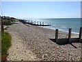
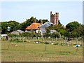
42 photos from this area
Area Information
Key information about the PO20 8EU including its size, population, and administrative classification.
- Area Type
- Postcode
- Area Size
- 4.4 hectares
- Population
- 1397
- Population Density
- 1816 people/km²
House Prices in PO20 8EU
37
Properties
£508,830
Average Sold Price
£1,000
Lowest Price
£965,000
Highest Price
Showing 37 properties
| Address | Type | Beds | Baths | Last Sale Price | Last Sale Date | |
|---|---|---|---|---|---|---|
| 10 Howard Avenue, West Wittering, PO20 8EU | Bungalow | 3 | 1 | £535,000 | Sep 2025 | |
| Treetops, 12 Howard Avenue, West Wittering, PO20 8EU | Bungalow | 3 | 2 | £635,000 | Aug 2025 | |
| Stonesthrow, 52 Howard Avenue, West Wittering, PO20 8EU | Bungalow | 4 | 3 | £775,000 | Mar 2025 | |
| 16 Howard Avenue, West Wittering, PO20 8EU | Detached | 5 | 5 | £895,000 | Nov 2023 | |
| Sanderlings, 58 Howard Avenue, West Wittering, PO20 8EU | Bungalow | - | - | £850,000 | Jun 2021 | |
| Cirrus, 56 Howard Avenue, West Wittering, PO20 8EU | Bungalow | 4 | 3 | £965,000 | Nov 2020 | |
| 14 Howard Avenue, West Wittering, PO20 8EU | Bungalow | 3 | 2 | £560,000 | Oct 2020 | |
| Limehouse, 62A Howard Avenue, West Wittering, PO20 8EU | Detached | 4 | 3 | £852,000 | Oct 2020 | |
| Chessel, 62 Howard Avenue, West Wittering, PO20 8EU | Detached | 4 | 3 | £855,000 | Mar 2020 | |
| Azul, 56A Howard Avenue, West Wittering, PO20 8EU | Detached | 4 | 3 | £930,000 | Jan 2020 |
Page 1 of 4
Energy Efficiency in PO20 8EU
Amenities
Schools
| Rank | School | Type | Entry gender | Ages |
|---|
Explore more schools in this area
Go to Schools tabDemographics
Household Size
Two person
most common
Accommodation Type
Houses
most common
Tenure
77
majority
Ethnic Group
White
most common
Religion
N/A
most common
Household Composition
N/A
most common
Age
47
median
Elderly (65+ years)
most common
Household Deprivation
N/A
with no deprivation
NS-SEC
35
in Lower managerial occupations
Explore more demographic insights in this area
Go to Demographics tabPlanning
Planning Constraints
- Flood RiskPremium
- Ramsar Wetland SitesPremium
- Area of Outstanding Natural BeautyPremium
- Protected Nature ReservePremium
- Protected WoodlandPremium