Area Overview for PO20 7NX
Photos of PO20 7NX
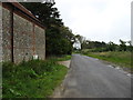
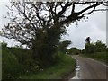
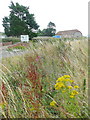
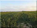
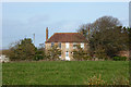
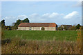
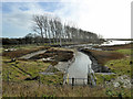
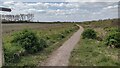
16 photos from this area
Area Information
Key information about the PO20 7NX including its size, population, and administrative classification.
- Area Type
- Postcode
- Area Size
- 2.5 km²
- Population
- 1304
- Population Density
- 80 people/km²
House Prices in PO20 7NX
10
Properties
£529,700
Average Sold Price
£251,500
Lowest Price
£750,000
Highest Price
Showing 10 properties
| Address | Type | Beds | Baths | Last Sale Price | Last Sale Date | |
|---|---|---|---|---|---|---|
| Galleon Cottage, Ham Road, Sidlesham, PO20 7NX | Detached | - | - | £750,000 | Aug 2017 | |
| Sheepwash Cottage, Ham Road, Sidlesham, PO20 7NX | house | - | - | £582,000 | Nov 2015 | |
| The Sheepwash, Ham Road, Sidlesham, PO20 7NX | house | - | - | £685,000 | Nov 2012 | |
| Brandywell Cottage, Ham Road, Sidlesham, PO20 7NX | house | - | - | £380,000 | May 2004 | |
| The Elms, Ham Road, Sidlesham, PO20 7NX | Detached | - | - | £251,500 | Jun 1996 | |
| Greenwood Farm House, Ham Road, Sidlesham, PO20 7NX | Detached | 5 | 3 | - | - | |
| Fairfields, Ham Road, Sidlesham, PO20 7NX | Detached | 3 | 2 | - | - | |
| Tennis 84M From Galleon Cottage, Ham Road 90M From Unnamed Road, Ham Lane, Sidlesham, PO20 7NX | Leisure | - | - | - | - | |
| Stapleys, Ham Road, Sidlesham, PO20 7NX | Detached | - | - | - | - | |
| Wilsons Farm, Ham Road, Sidlesham, PO20 7NX | Detached | - | - | - | - |
Energy Efficiency in PO20 7NX
Amenities
Schools
| Rank | School | Type | Entry gender | Ages |
|---|
Explore more schools in this area
Go to Schools tabDemographics
Household Size
Two person
most common
Accommodation Type
Houses
most common
Tenure
79
majority
Ethnic Group
White
most common
Religion
N/A
most common
Household Composition
N/A
most common
Age
47
median
Adults (30-64 years)
most common
Household Deprivation
N/A
with no deprivation
NS-SEC
40
in Lower managerial occupations
Explore more demographic insights in this area
Go to Demographics tabPlanning
Planning Constraints
- Flood RiskPremium
- Ramsar Wetland SitesPremium
- Area of Outstanding Natural BeautyPremium
- Protected Nature ReservePremium
- Protected WoodlandPremium