Area Overview for PO20 7JR
Photos of PO20 7JR
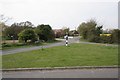
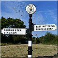
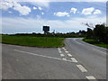
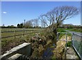
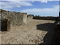

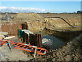
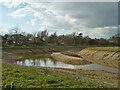
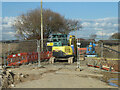
20 photos from this area
Area Information
Key information about the PO20 7JR including its size, population, and administrative classification.
- Area Type
- Postcode
- Area Size
- 19.3 hectares
- Population
- 2361
- Population Density
- 273 people/km²
House Prices in PO20 7JR
9
Properties
£235,000
Average Sold Price
£235,000
Lowest Price
£235,000
Highest Price
Showing 9 properties
| Address | Type | Beds | Baths | Last Sale Price | Last Sale Date | |
|---|---|---|---|---|---|---|
| Cheraw Nursery, 134 Almodington Lane, Almodington, Earnley, PO20 7JR | Detached | - | - | £235,000 | Apr 1999 | |
| Holly House, 133 Almodington Lane, Almodington, Earnley, PO20 7JR | Detached | 4 | 5 | - | - | |
| 137A Almodington Lane, Almodington, Earnley, PO20 7JR | Bungalow | 3 | 2 | - | - | |
| Stables, Cheraw Nursery, 134 Almodington Lane, Almodington, Earnley, PO20 7JR | Equestrian | - | - | - | - | |
| Southern Counties Tractors, Almodington Lane, Almodington, Earnley, PO20 7JR | Industrial | - | - | - | - | |
| Somerley Farm House, Almodington Lane, Almodington, Earnley, PO20 7JR | restaurant_cafe | - | - | - | - | |
| Caravan, Cheraw Nursery, 134 Almodington Lane, Almodington, Earnley, PO20 7JR | Mobile Home | - | - | - | - | |
| 136 Almodington Lane, Almodington, Earnley, PO20 7JR | Detached | - | - | - | - | |
| Kingsmere Nursery, 135 Almodington Lane, Almodington, Earnley, PO20 7JR | Detached | - | - | - | - |
Energy Efficiency in PO20 7JR
Amenities
Schools
| Rank | School | Type | Entry gender | Ages |
|---|
Explore more schools in this area
Go to Schools tabDemographics
Household Size
Two person
most common
Accommodation Type
Houses
most common
Tenure
79
majority
Ethnic Group
White
most common
Religion
N/A
most common
Household Composition
N/A
most common
Age
47
median
Adults (30-64 years)
most common
Household Deprivation
N/A
with no deprivation
NS-SEC
34
in Lower managerial occupations
Explore more demographic insights in this area
Go to Demographics tabPlanning
Planning Constraints
- Flood RiskPremium
- Ramsar Wetland SitesPremium
- Area of Outstanding Natural BeautyPremium
- Protected Nature ReservePremium
- Protected WoodlandPremium