Area Overview for PO20 7JJ
Photos of PO20 7JJ
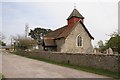

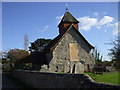
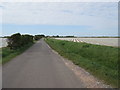


54 photos from this area
Area Information
Key information about the PO20 7JJ including its size, population, and administrative classification.
- Area Type
- Postcode
- Area Size
- 12.5 hectares
- Population
- 2361
- Population Density
- 273 people/km²
House Prices in PO20 7JJ
22
Properties
£459,210
Average Sold Price
£225,000
Lowest Price
£787,500
Highest Price
Showing 22 properties
| Address | Type | Beds | Baths | Last Sale Price | Last Sale Date | |
|---|---|---|---|---|---|---|
| Drift, Clappers Lane, Earnley, PO20 7JJ | Detached | 4 | 2 | £787,500 | Sep 2023 | |
| La Brisa, Clappers Lane, Earnley, PO20 7JJ | Detached | 6 | 4 | £690,000 | Feb 2022 | |
| Gull House, Clappers Lane, Earnley, PO20 7JJ | Semi-detached | 3 | 1 | £502,000 | Aug 2020 | |
| Milburn Cottage, Clappers Lane, Earnley, PO20 7JJ | Detached | 4 | 1 | £520,000 | Oct 2019 | |
| Chilterns, Clappers Lane, Earnley, PO20 7JJ | house | - | - | £430,000 | Feb 2019 | |
| Windskip, Clappers Lane, Earnley, PO20 7JJ | Detached | 4 | 2 | £551,000 | Jan 2018 | |
| Seaview, Clappers Lane, Earnley, PO20 7JJ | Detached | 5 | 3 | £391,577 | Aug 2016 | |
| The White House, Clappers Lane, Earnley, PO20 7JJ | Detached | 4 | - | £515,000 | Mar 2016 | |
| Charrings, Clappers Lane, Earnley, PO20 7JJ | Detached | 3 | - | £575,000 | Aug 2014 | |
| Millstone, Clappers Lane, Earnley, PO20 7JJ | house | 4 | - | £607,500 | Feb 2012 |
Page 1 of 3
Energy Efficiency in PO20 7JJ
Amenities
Schools
| Rank | School | Type | Entry gender | Ages |
|---|
Explore more schools in this area
Go to Schools tabDemographics
Household Size
Two person
most common
Accommodation Type
Houses
most common
Tenure
79
majority
Ethnic Group
White
most common
Religion
N/A
most common
Household Composition
N/A
most common
Age
47
median
Adults (30-64 years)
most common
Household Deprivation
N/A
with no deprivation
NS-SEC
34
in Lower managerial occupations
Explore more demographic insights in this area
Go to Demographics tabPlanning
Planning Constraints
- Flood RiskPremium
- Ramsar Wetland SitesPremium
- Area of Outstanding Natural BeautyPremium
- Protected Nature ReservePremium
- Protected WoodlandPremium