Area Overview for PO20 7DD
Photos of PO20 7DD


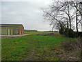


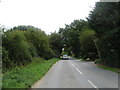
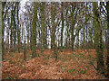
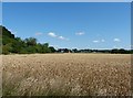
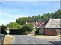
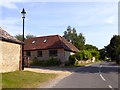
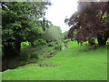
33 photos from this area
Area Information
Key information about the PO20 7DD including its size, population, and administrative classification.
- Area Type
- Postcode
- Area Size
- 7.9 hectares
- Population
- 2016
- Population Density
- 248 people/km²
House Prices in PO20 7DD
20
Properties
£642,834
Average Sold Price
£31,920
Lowest Price
£2,075,000
Highest Price
Showing 20 properties
| Address | Type | Beds | Baths | Last Sale Price | Last Sale Date | |
|---|---|---|---|---|---|---|
| Glebe Cottage, Itchenor Road, West Itchenor, PO20 7DD | house | 3 | 2 | £1,361,134 | Sep 2024 | |
| Russett Cottage, Itchenor Road, West Itchenor, PO20 7DD | house | - | - | £2,075,000 | Jun 2021 | |
| Drake Cottage, Itchenor Road, West Itchenor, PO20 7DD | Detached | - | - | £31,920 | Jan 2021 | |
| Little Thatches, Itchenor Road, West Itchenor, PO20 7DD | Detached | - | - | £60,200 | Jan 2021 | |
| Four Winds, Itchenor Road, West Itchenor, PO20 7DD | Detached | - | - | £32,830 | Jan 2021 | |
| Little Court, Itchenor Road, West Itchenor, PO20 7DD | house | - | - | £34,265 | Jan 2021 | |
| Acklam, Itchenor Road, West Itchenor, PO20 7DD | house | - | - | £1,100,000 | Nov 2020 | |
| Stowfell, Itchenor Road, West Itchenor, PO20 7DD | house | - | - | £685,000 | Aug 2020 | |
| Woodberry Cottage, Itchenor Road, West Itchenor, PO20 7DD | Detached | 3 | 2 | £715,000 | Aug 2019 | |
| Sandpiper, Itchenor Road, West Itchenor, PO20 7DD | Detached | 5 | 4 | £1,150,000 | Aug 2019 |
Page 1 of 2
Energy Efficiency in PO20 7DD
Amenities
Schools
| Rank | School | Type | Entry gender | Ages |
|---|
Explore more schools in this area
Go to Schools tabDemographics
Household Size
Two person
most common
Accommodation Type
Houses
most common
Tenure
79
majority
Ethnic Group
White
most common
Religion
N/A
most common
Household Composition
N/A
most common
Age
47
median
Adults (30-64 years)
most common
Household Deprivation
N/A
with no deprivation
NS-SEC
47
in Lower managerial occupations
Explore more demographic insights in this area
Go to Demographics tabPlanning
Planning Constraints
- Flood RiskPremium
- Ramsar Wetland SitesPremium
- Area of Outstanding Natural BeautyPremium
- Protected Nature ReservePremium
- Protected WoodlandPremium