Area Overview for PO20 3UX
Photos of PO20 3UX
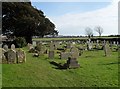
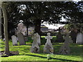
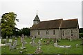
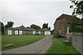

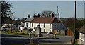
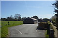
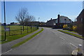
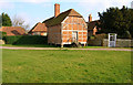
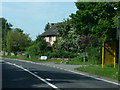
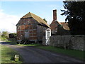

69 photos from this area
Area Information
Key information about the PO20 3UX including its size, population, and administrative classification.
- Area Type
- Postcode
- Area Size
- 8274 m²
- Population
- 1841
- Population Density
- 344 people/km²
House Prices in PO20 3UX
7
Properties
£299,875
Average Sold Price
£196,500
Lowest Price
£397,000
Highest Price
Showing 7 properties
| Address | Type | Beds | Baths | Last Sale Price | Last Sale Date | |
|---|---|---|---|---|---|---|
| Mardale, Church Lane, Eastergate, PO20 3UX | Bungalow | - | - | £301,000 | Dec 2025 | |
| Fir Tree, Church Lane, Eastergate, PO20 3UX | Bungalow | - | - | £397,000 | Sep 2019 | |
| West Lodge, Church Lane, Eastergate, PO20 3UX | Semi-detached | 3 | - | £305,000 | Nov 2013 | |
| Deva, Church Lane, Eastergate, PO20 3UX | Bungalow | - | - | £196,500 | Aug 2011 | |
| 3, Manor Farm Cottages, Church Lane, Eastergate, PO20 3UX | Semi-detached | - | - | - | - | |
| 4, Manor Farm Cottages, Church Lane, Eastergate, PO20 3UX | Semi-detached | - | - | - | - | |
| Manor Farm Cottage, Church Lane, Eastergate, PO20 3UX | Detached | - | - | - | - |
Energy Efficiency in PO20 3UX
Amenities
Schools
| Rank | School | Type | Entry gender | Ages |
|---|
Explore more schools in this area
Go to Schools tabDemographics
Household Size
Two person
most common
Accommodation Type
Houses
most common
Tenure
83
majority
Ethnic Group
White
most common
Religion
N/A
most common
Household Composition
N/A
most common
Age
47
median
Adults (30-64 years)
most common
Household Deprivation
N/A
with no deprivation
NS-SEC
37
in Lower managerial occupations
Explore more demographic insights in this area
Go to Demographics tabPlanning
Planning Constraints
- Flood RiskPremium
- Ramsar Wetland SitesPremium
- Area of Outstanding Natural BeautyPremium
- Protected Nature ReservePremium
- Protected WoodlandPremium