Area Overview for PO20 3UA
Photos of PO20 3UA


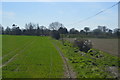
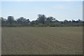


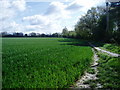


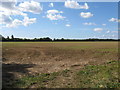

19 photos from this area
Area Information
Key information about the PO20 3UA including its size, population, and administrative classification.
- Area Type
- Postcode
- Area Size
- 15.2 hectares
- Population
- 2434
- Population Density
- 527 people/km²
House Prices in PO20 3UA
18
Properties
£354,207
Average Sold Price
£115,000
Lowest Price
£715,000
Highest Price
Showing 18 properties
| Address | Type | Beds | Baths | Last Sale Price | Last Sale Date | |
|---|---|---|---|---|---|---|
| Fairview, Nyton Road, Aldingbourne, PO20 3UA | Bungalow | 3 | 1 | £394,950 | Nov 2016 | |
| Marriners, Nyton Road, Aldingbourne, PO20 3UA | house | - | - | £522,000 | Oct 2016 | |
| Bonne House, Nyton Road, Aldingbourne, PO20 3UA | Detached | - | - | £715,000 | Aug 2015 | |
| Honiton, Nyton Road, Aldingbourne, PO20 3UA | house | 4 | - | £380,000 | Apr 2011 | |
| Field Place, Nyton Road, Aldingbourne, PO20 3UA | Semi-detached | - | - | £230,000 | Oct 2003 | |
| Quercus, Nyton Road, Aldingbourne, PO20 3UA | Bungalow | - | - | £122,500 | Sep 2000 | |
| Shamballa, Nyton Road, Aldingbourne, PO20 3UA | Detached | - | - | £115,000 | Feb 1996 | |
| Larksmead, Nyton Road, Aldingbourne, PO20 3UA | Detached | 5 | 2 | - | - | |
| Southview, Nyton Road, Aldingbourne, PO20 3UA | Detached | 5 | 2 | - | - | |
| Sweet & Savoury Catering Services, Office 1 Unit 1, Allens Yard, Nyton Road, Aldingbourne, PO20 3UA | Office | - | - | - | - |
Page 1 of 2
Energy Efficiency in PO20 3UA
Amenities
Schools
| Rank | School | Type | Entry gender | Ages |
|---|
Explore more schools in this area
Go to Schools tabDemographics
Household Size
Two person
most common
Accommodation Type
Houses
most common
Tenure
78
majority
Ethnic Group
White
most common
Religion
N/A
most common
Household Composition
N/A
most common
Age
47
median
Adults (30-64 years)
most common
Household Deprivation
N/A
with no deprivation
NS-SEC
39
in Lower managerial occupations
Explore more demographic insights in this area
Go to Demographics tabPlanning
Planning Constraints
- Flood RiskPremium
- Ramsar Wetland SitesPremium
- Area of Outstanding Natural BeautyPremium
- Protected Nature ReservePremium
- Protected WoodlandPremium