Area Overview for PO20 2BY
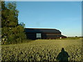
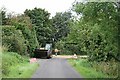
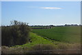
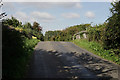
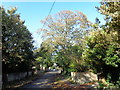
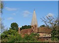
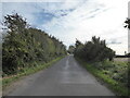
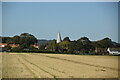
Photos of PO20 2BY


Area Information
Living in PO20 2BY offers a quiet residential experience within a small cluster covering just 1.5 hectares. This specific postcode serves approximately 1,715 people, resulting in a population density of 123 people per square kilometre. Such low density typically defines the character of this neighbourhood as a calm, suburban setting away from the immediate bustle of larger towns. The area is situated in England, providing a distinct slice of countryside living while maintaining essential connections to the wider region. Residents here likely value the space and seclusion that come with a smaller population count, yet they remain close to significant transport hubs and retail destinations. Daily life revolves around the balance between a relaxed pace and practical accessibility to Chichester, Bognor Regis, and Barnham. The size of the area means that local streets are manageable, often fostering a sense of familiar surroundings for long-term inhabitants. For those considering homes in PO20 2BY, the environment suggests a community where neighbours may know each other through proximity rather than the high-pressure social dynamics found in dense urban centres. You will find a setting defined by its manageable scale and functional integration with nearby towns and rail stations.
- Area Type
- Postcode
- Area Size
- 1.5 hectares
- Population
- 1715
- Population Density
- 123 people/km²
The housing landscape within PO20 2BY is defined by its composition of houses and a strong home ownership rate of 60%. This statistic indicates that the majority of residents have purchased their properties, creating a market characterised by stability rather than a volatile letting sector. As a small residential cluster covering only 1.5 hectares, the variety of architectural styles is likely more limited compared to larger postcodes. You are looking at an area where homes in PO20 2BY are predominantly owned, which often simplifies renting issues if you know someone selling locally. The presence of houses suggests a suburban or rural edge feel, typical of the South Downs area around Goodwood and Chichester. Buyers here typically find established dwellings rather than new-build developments or high-density flats. The low population density of 123 people per square kilometre supports the idea that properties will have more space and potentially larger plots compared to city centres. This market structure appeals to those who prefer the security of owning a home and the quiet associated with lower-density living. It is a market driven by local maintenance and community standards rather than speculative investment trends.
House Prices in PO20 2BY
Showing 6 properties
| Address | Type | Beds | Baths | Last Sale Price | Last Sale Date | |
|---|---|---|---|---|---|---|
| 2 Briar Close, Oving, PO20 2BY | Bungalow | - | - | £345,000 | Nov 2007 | |
| 1 Briar Close, Oving, PO20 2BY | Detached | - | - | £186,000 | Aug 2001 | |
| 6 Briar Close, Oving, PO20 2BY | Detached | - | - | £225,000 | Mar 2001 | |
| 5 Briar Close, Oving, PO20 2BY | Detached | - | - | £150,000 | Oct 1998 | |
| 4 Briar Close, Oving, PO20 2BY | Detached | - | - | - | - | |
| 3 Briar Close, Oving, PO20 2BY | Detached | - | - | - | - |
Energy Efficiency in PO20 2BY
Residents of PO20 2BY benefit from a range of amenities within practical reach for shopping, travel, and leisure. For retail needs, you have five notable options including Co-op Tangmere, Asda Tangmere, and M&S Chichester. These superstores provide everything from groceries to general goods without the need for long drives to larger cities. Travel options are extensive, with five rail stations nearby including Chichester Railway Station, Barnham Railway Station, and Bognor Regis Railway Station. Chichester/Goodwood Airport is also located nearby, offering air travel connectivity for those requiring faster transport links. The proximity to Barnham and Bognor Regis suggests good bus or train connections to the wider South Downs rail network. This connectivity means you can commute to work in London or Brighton while living in a quieter postcode. The presence of multiple nearby stations creates a flexible transport web, reducing reliance on cars for daily journeys. You can access日常 necessities in Tangmere while retaining the option of quick train trips to Chichester for larger shopping or dining experiences. This balance of local convenience and regional access defines the practical lifestyle available here.
Amenities
Schools
Families residing in PO20 2BY have access to specific educational facilities within practical reach. The area includes Westbourne House School, which operates as an independent institution. This option provides an alternative to the state sector for parents seeking a private education for their children. The inclusion of an independent school suggests that the local catchment area supports families with the means to choose a specific type of schooling environment. While this postcode does not list comprehensive state schools in the immediate vicinity, the presence of Westbourne House School indicates a focus on private education options near this residential cluster. You should verify specific admission criteria and catchment zones directly with the school administration before making a commitment. The educational landscape is relatively specific, offering a single named independent option rather than a broad mix of primary, secondary, and independent state schools. This scarcity of listed schools means that commuting to other towns like Chichester or Horsham might be necessary for additional educational choices. Parents in PO20 2BY typically balance local private schooling with the possibility of travel to larger educational hubs further away.
| Rank | School | Type | Entry gender | Ages |
|---|
Explore more schools in this area
Go to Schools tabDemographics
The community profile of PO20 2BY reflects a mature population, with a median age of 47 years. Most residents fall into the adult age range of 30 to 64 years, indicating that families and established professionals dominate the local demographic. Over 60% of households own their homes, which points to a stable, owner-occupied community rather than a transient rental market. This high level of home ownership often correlates with longer-term settlement and investment in local upkeep. The area consists primarily of houses, offering a residential feel distinct from apartment blocks or commercial estates. The predominant ethnic group is White, aligning with the broader demographic trends of the region. You can expect a neighbourhood where the population has settled deeply, with a workforce aged between 30 and 64 providing stability to the local economy. The age profile suggests that young children may represent a smaller proportion of the census data, while school-aged children and older adults make up a significant portion of the remaining percentage. This demographic makes up the bulk of the 1,715 residents living in this specific postcode. Understanding these figures helps clarify that this is likely not a young professional starter area but rather a place for established households seeking quiet domestic life.
Household Size
Accommodation Type
Tenure
Ethnic Group
Religion
Household Composition
Age
Household Deprivation
NS-SEC
Explore more demographic insights in this area
Go to Demographics tabPlanning
Planning Constraints
- Flood RiskPremium
- Ramsar Wetland SitesPremium
- Area of Outstanding Natural BeautyPremium
- Protected Nature ReservePremium
- Protected WoodlandPremium