Area Overview for PO20 0SW
Photos of PO20 0SW
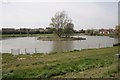
37 photos from this area
Area Information
Key information about the PO20 0SW including its size, population, and administrative classification.
- Area Type
- Postcode
- Area Size
- 1.3 hectares
- Population
- 1740
- Population Density
- 316 people/km²
House Prices in PO20 0SW
29
Properties
£205,104
Average Sold Price
£59,950
Lowest Price
£360,000
Highest Price
Showing 29 properties
| Address | Type | Beds | Baths | Last Sale Price | Last Sale Date | |
|---|---|---|---|---|---|---|
| 12 Marine Drive, Selsey, PO20 0SW | Semi-detached | 2 | 1 | £245,000 | Oct 2024 | |
| 35 Marine Drive, Selsey, PO20 0SW | Bungalow | 2 | 1 | £305,000 | May 2024 | |
| 17 Marine Drive, Selsey, PO20 0SW | Bungalow | 2 | - | £310,000 | Feb 2023 | |
| 39 Marine Drive, Selsey, PO20 0SW | Bungalow | 2 | 2 | £342,500 | Sep 2021 | |
| 28 Marine Drive, Selsey, PO20 0SW | Bungalow | 2 | - | £360,000 | Sep 2021 | |
| 22 Marine Drive, Selsey, PO20 0SW | Semi-detached | 2 | 1 | £258,000 | Dec 2020 | |
| 19 Marine Drive, Selsey, PO20 0SW | Semi-detached | 2 | 1 | £234,000 | Sep 2019 | |
| 9 Marine Drive, Selsey, PO20 0SW | Bungalow | 2 | 1 | £217,500 | May 2014 | |
| 27 Marine Drive, Selsey, PO20 0SW | Bungalow | 2 | - | £170,000 | Dec 2012 | |
| 20 Marine Drive, Selsey, PO20 0SW | Bungalow | 2 | - | £175,000 | Oct 2012 |
Page 1 of 3
Energy Efficiency in PO20 0SW
Amenities
Schools
| Rank | School | Type | Entry gender | Ages |
|---|
Explore more schools in this area
Go to Schools tabDemographics
Household Size
Two person
most common
Accommodation Type
Houses
most common
Tenure
84
majority
Ethnic Group
White
most common
Religion
N/A
most common
Household Composition
N/A
most common
Age
47
median
Elderly (65+ years)
most common
Household Deprivation
N/A
with no deprivation
NS-SEC
28
in Lower managerial occupations
Explore more demographic insights in this area
Go to Demographics tabPlanning
Planning Constraints
- Flood RiskPremium
- Ramsar Wetland SitesPremium
- Area of Outstanding Natural BeautyPremium
- Protected Nature ReservePremium
- Protected WoodlandPremium