Area Overview for PO2 8QG
Photos of PO2 8QG
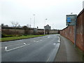
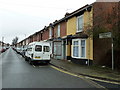
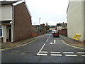
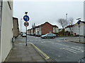
100 photos from this area
Area Information
Key information about the PO2 8QG including its size, population, and administrative classification.
- Area Type
- Postcode
- Area Size
- 7098 m²
- Population
- 1576
- Population Density
- 13728 people/km²
House Prices in PO2 8QG
53
Properties
£133,079
Average Sold Price
£43,000
Lowest Price
£227,500
Highest Price
Showing 53 properties
| Address | Type | Beds | Baths | Last Sale Price | Last Sale Date | |
|---|---|---|---|---|---|---|
| 66 Gruneisen Road, Portsmouth, PO2 8QG | Terraced | 2 | 1 | £208,000 | Jun 2025 | |
| 100 Gruneisen Road, Portsmouth, PO2 8QG | Terraced | 3 | 2 | £215,000 | May 2025 | |
| 42 Gruneisen Road, Portsmouth, PO2 8QG | Terraced | 2 | 1 | £225,000 | Mar 2025 | |
| 70 Gruneisen Road, Portsmouth, PO2 8QG | Terraced | 3 | 2 | £227,500 | Jul 2023 | |
| 36 Gruneisen Road, Portsmouth, PO2 8QG | Terraced | 2 | 1 | £205,000 | May 2023 | |
| 34 Gruneisen Road, Portsmouth, PO2 8QG | Retail | 2 | - | £200,000 | Jul 2022 | |
| 38 Gruneisen Road, Portsmouth, PO2 8QG | Terraced | 2 | 1 | £175,000 | Jun 2021 | |
| 68 Gruneisen Road, Portsmouth, PO2 8QG | Terraced | 2 | 1 | £180,000 | Oct 2020 | |
| 46 Gruneisen Road, Portsmouth, PO2 8QG | Terraced | 2 | 1 | £159,000 | Sep 2020 | |
| 16 Gruneisen Road, Portsmouth, PO2 8QG | Terraced | 2 | 1 | £170,000 | Jul 2020 |
Page 1 of 6
Energy Efficiency in PO2 8QG
Amenities
Schools
| Rank | School | Type | Entry gender | Ages |
|---|
Explore more schools in this area
Go to Schools tabDemographics
Household Size
One person
most common
Accommodation Type
Houses
most common
Tenure
52
majority
Ethnic Group
White
most common
Religion
N/A
most common
Household Composition
N/A
most common
Age
47
median
Adults (30-64 years)
most common
Household Deprivation
N/A
with no deprivation
NS-SEC
26
in Lower managerial occupations
Explore more demographic insights in this area
Go to Demographics tabPlanning
Planning Constraints
- Flood RiskPremium
- Ramsar Wetland SitesPremium
- Area of Outstanding Natural BeautyPremium
- Protected Nature ReservePremium
- Protected WoodlandPremium