Area Overview for PO2 7PF
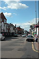
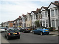
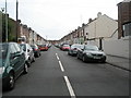
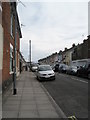
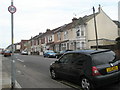
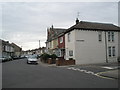
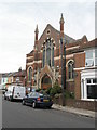
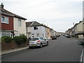
Photos of PO2 7PF
Area Information
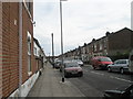
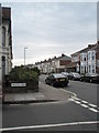
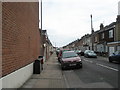
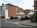
The PO2 7PF postcode is a specific residential cluster within Portsmouth, England, housing a population of 1732 residents. This small area represents a distinct pocket of the wider city, offering a compact living environment for those seeking a defined community feel. You will find that daily life here centres around practical convenience, with immediate access to major transport hubs and retail facilities. The location sits close to the city centre, providing quick connections to Portsmouth International Cruise & Ferry Terminal and several railway stations within practical reach. This proximity means you can commute to Fratton, Hilsea, or Portsmouth & Southsea Railway Station with relative ease, making it suitable for workers depending on the Southern routes. Living in PO2 7PF often means navigating a landscape shaped by its proximity to key infrastructure. The area is designated as a small residential cluster, which typically implies a mix of built-up housing and limited open space compared to larger suburbs. You are surrounded by significant traffic flows associated with the ferry terminals and rail networks, which defines the area's character as a transit-focused zone. Despite being an urban postcode, the density allows for easy pedestrian access to local shops like Aldi Kingston and Spar. The PSR ID PO2 anchors this location firmly within the Portsmouth property market, serving as a gateway between residential zones and the port's operational heart.
- Area Type
- Postcode
- Area Size
- Not available
- Population
- 1732
- Population Density
- 9774 people/km²
The property market in PO2 7PF is defined by a specific accommodation profile that limits options to flats. This scarcity of house types means you will rarely find detached or semi-detached properties available here; instead, the stock consists largely of apartment living. With only 29% home ownership in the area, the market operates heavily on a rental basis. This high tenancy rate indicates that many homes are leased to tenants rather than owned by residents, suggesting a dynamic environment where landlord portfolios may dominate. Prospective buyers should approach this postcode with realistic expectations regarding chain-free purchases, as the low ownership figure implies fewer owner-occupied sellers on the market at any single time. Living in PO2 7PF often requires engaging with the rental sector or looking for specific flat developments rather than traditional family homes. The dominance of flats aligns with the area's location near ferry terminals and railway stations, catering to commuters and professionals who prioritise location over space. You will find that demand for these properties remains steady due to the strategic transport links. However, the lack of house variety means competition for suitable flats can be intense. If you are looking for a garden or multiple-storey detached house, PO2 7PF does not offer this housing stock. Instead, the area provides a convenient, albeit compact, living space for those who value proximity to Portsmouth Ports and the city centre over traditional suburban sprawl.
House Prices in PO2 7PF
No properties found in this postcode.
Energy Efficiency in PO2 7PF
Residents of PO2 7PF enjoy immediate access to a range of retail and leisure amenities that support daily convenience. Within practical reach, you will find five notable retail locations including Tesco Portsmouth, Aldi Kingston, and Spar. These shops provide essential grocery needs and general merchandise without the need for long journeys. The area also boasts five ferry-related amenities, connecting you directly to Portsmouth International Cruise & Ferry Terminal and Portsmouth IOW Car Ferry Terminal. This proximity to maritime transport adds a unique dimension to local life, with ferries and cruise activities likely visible or audible nearby. The lifestyle here is characterised by convenience and accessibility to major transport nodes. You can walk or take a short ride to Fratton Railway Station or Portsmouth Harbour Station Pier to catch your train or boat. Five rail stations are located close by, offering extensive connectivity to the rest of the UK. For those who prefer quieter evenings, the immediate access to ferry terminals suggests a dynamic coastal atmosphere, potentially hosting events or terminus activities. The presence of multiple supermarkets ensures you can stock up on groceries immediately after work. Living in PO2 7PF means you rarely have to travel far for basic needs, as your shops and transport links are effectively on your doorstep.
Amenities
Schools
Families living in PO2 7PF have access to several educational institutions nearby, all bearing the name Flying Bull. The cluster includes Flying Bull Infant School, Flying Bull Junior School, and Flying Bull Primary School, which collectively provide early years and primary education. Further down the line, The Flying Bull Academy stands as the academic institution for older students. This naming convention across multiple levels suggests a cohesive educational zone designed to serve the local catchment area comprehensively. You will find that the area offers a continuous schooling path from infancy through to academy-level education. This concentration of schools indicates that the local authority has prioritised educational capacity in this specific postcode district. The presence of both infant/junior/priamry splits and an academy implies a structured approach to schooling within reach. Parents considering PO2 7PF will appreciate that their children can walk or take a short bus ride to attend these facilities without needing to commute across the wider city. The schools listed are the primary and only ones provided for this area, suggesting a focused educational bubble. While the data does not specify Ofsted ratings for these individual institutions, the variety of school types ensures that there are options for different age groups within a tight radius. For those moving into the area, knowing that Flying Bull Academy serves as the final pre-secondary stop is a key planning factor. This density of educational provision supports families who value convenience in their daily routines.
| Rank | School | Type | Entry gender | Ages |
|---|
Explore more schools in this area
Go to Schools tabDemographics
The community in PO2 7PF reflects a mature demographic profile, with a median age of 47 years. Most residents fall into the adult age range of 30 to 64 years, indicating an area populated primarily by individuals in their middle years. This age distribution suggests a neighbourhood where families with older children or empty nesters might be settled, rather than a zone dominated by young professionals or students. You will find that 29% of households own their homes outright, while the majority of the population likely rents, pointing towards a significant tenant base in this specific postcode. The predominant ethnic group in PO2 7PF is White, which aligns with the broader demographic trends of the Portsmouth region. Accommodation in this area is characterised almost exclusively by flats, distinguishing it from areas containing detached or semi-detached houses. This high concentration of flat living supports the area's urban nature and its proximity to transport links that benefit density. The age skew towards adults means you will encounter fewer single-person households compared to younger postcodes, yet the high rental proportion suggests a fluid tenant market. While the area lacks the diversity found in more international university districts, the stable age group provides a sense of established routine. For buyers looking at homes in PO2 7PF, understanding this age-weighted profile helps anticipate a quieter, less transient atmosphere than might be found in student-heavy clusters.
Household Size
Accommodation Type
Tenure
Ethnic Group
Religion
Household Composition
Age
Household Deprivation
NS-SEC
Explore more demographic insights in this area
Go to Demographics tabPlanning
Planning Constraints
- Flood RiskPremium
- Ramsar Wetland SitesPremium
- Area of Outstanding Natural BeautyPremium
- Protected Nature ReservePremium
- Protected WoodlandPremium