Area Overview for PO2 7JB
Photos of PO2 7JB
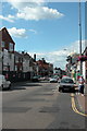
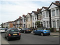
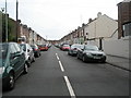
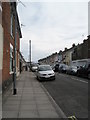
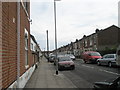
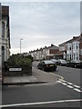
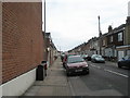
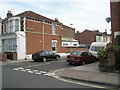
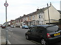
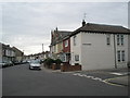
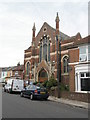
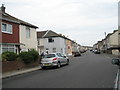
100 photos from this area
Area Information
Key information about the PO2 7JB including its size, population, and administrative classification.
- Area Type
- Postcode
- Area Size
- 9160 m²
- Population
- Not available
- Population Density
- Not available
House Prices in PO2 7JB
39
Properties
£157,312
Average Sold Price
£43,995
Lowest Price
£280,000
Highest Price
Showing 39 properties
| Address | Type | Beds | Baths | Last Sale Price | Last Sale Date | |
|---|---|---|---|---|---|---|
| 64 Portchester Road, Portsmouth, PO2 7JB | Terraced | 4 | 3 | £280,000 | Apr 2024 | |
| 4 Portchester Road, Portsmouth, PO2 7JB | Terraced | 3 | 1 | £260,000 | Dec 2023 | |
| 20 Portchester Road, Portsmouth, PO2 7JB | Terraced | 3 | 1 | £256,000 | Sep 2023 | |
| 36 Portchester Road, Portsmouth, PO2 7JB | Terraced | 3 | 1 | £226,000 | Aug 2023 | |
| 46 Portchester Road, Portsmouth, PO2 7JB | Terraced | - | - | £95,000 | Mar 2023 | |
| 66 Portchester Road, Portsmouth, PO2 7JB | Terraced | 3 | 1 | £267,000 | Feb 2023 | |
| 2 Portchester Road, Portsmouth, PO2 7JB | Terraced | 3 | 1 | £258,500 | Sep 2022 | |
| 56 Portchester Road, Portsmouth, PO2 7JB | house | 3 | 1 | £265,000 | Aug 2022 | |
| 50 Portchester Road, Portsmouth, PO2 7JB | Terraced | 3 | 1 | £200,000 | Feb 2020 | |
| 62 Portchester Road, Portsmouth, PO2 7JB | Terraced | 3 | 1 | £180,000 | Sep 2016 |
Page 1 of 4
Energy Efficiency in PO2 7JB
Amenities
Schools
| Rank | School | Type | Entry gender | Ages |
|---|
Explore more schools in this area
Go to Schools tabDemographics
Household Size
Family (3-5 people)
most common
Accommodation Type
Houses
most common
Tenure
70
majority
Ethnic Group
White
most common
Religion
N/A
most common
Household Composition
N/A
most common
Age
47
median
Adults (30-64 years)
most common
Household Deprivation
N/A
with no deprivation
NS-SEC
26
in Lower managerial occupations
Explore more demographic insights in this area
Go to Demographics tabPlanning
Planning Constraints
- Flood RiskPremium
- Ramsar Wetland SitesPremium
- Area of Outstanding Natural BeautyPremium
- Protected Nature ReservePremium
- Protected WoodlandPremium