Area Overview for PO2 0JG
Photos of PO2 0JG
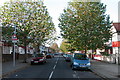
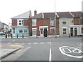
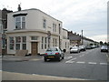
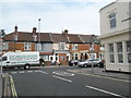
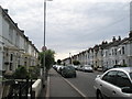
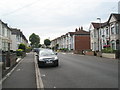
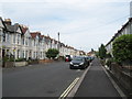
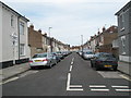
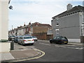
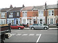
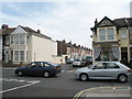
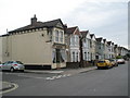
100 photos from this area
Area Information
Key information about the PO2 0JG including its size, population, and administrative classification.
- Area Type
- Postcode
- Area Size
- 5170 m²
- Population
- 1425
- Population Density
- 11905 people/km²
House Prices in PO2 0JG
35
Properties
£161,326
Average Sold Price
£46,000
Lowest Price
£295,000
Highest Price
Showing 35 properties
| Address | Type | Beds | Baths | Last Sale Price | Last Sale Date | |
|---|---|---|---|---|---|---|
| 5, Richborough Court, Stubbington Avenue, Portsmouth, PO2 0JG | Flat | 1 | 1 | £140,000 | May 2023 | |
| 78 Stubbington Avenue, Portsmouth, PO2 0JG | Terraced | 3 | 2 | £295,000 | Dec 2021 | |
| 98 Stubbington Avenue, Portsmouth, PO2 0JG | Terraced | 4 | - | £280,000 | Apr 2021 | |
| 112 Stubbington Avenue, Portsmouth, PO2 0JG | house | - | - | £280,000 | Apr 2021 | |
| 110 Stubbington Avenue, Portsmouth, PO2 0JG | Terraced | 4 | 1 | £247,500 | Jan 2020 | |
| 76 Stubbington Avenue, Portsmouth, PO2 0JG | Terraced | 3 | 1 | £275,000 | Jan 2019 | |
| 2, Richborough Court, Stubbington Avenue, Portsmouth, PO2 0JG | Flat | 1 | 1 | £91,000 | Aug 2018 | |
| 82 Stubbington Avenue, Portsmouth, PO2 0JG | Terraced | 3 | 2 | £194,100 | Jul 2015 | |
| 104 Stubbington Avenue, Portsmouth, PO2 0JG | Terraced | 4 | 2 | £220,000 | Mar 2013 | |
| 4, Richborough Court, Stubbington Avenue, Portsmouth, PO2 0JG | Flat | 1 | - | £46,000 | May 2008 |
Page 1 of 4
Energy Efficiency in PO2 0JG
Amenities
Schools
| Rank | School | Type | Entry gender | Ages |
|---|
Explore more schools in this area
Go to Schools tabDemographics
Household Size
Family (3-5 people)
most common
Accommodation Type
Houses
most common
Tenure
80
majority
Ethnic Group
White
most common
Religion
N/A
most common
Household Composition
N/A
most common
Age
47
median
Adults (30-64 years)
most common
Household Deprivation
N/A
with no deprivation
NS-SEC
31
in Lower managerial occupations
Explore more demographic insights in this area
Go to Demographics tabPlanning
Planning Constraints
- Flood RiskPremium
- Ramsar Wetland SitesPremium
- Area of Outstanding Natural BeautyPremium
- Protected Nature ReservePremium
- Protected WoodlandPremium