Area Overview for PO2 0BY
Photos of PO2 0BY
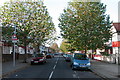
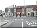
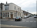
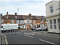
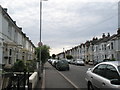
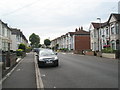
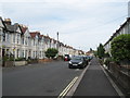
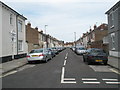
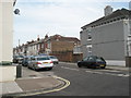
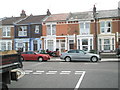
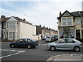
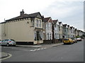
100 photos from this area
Area Information
Key information about the PO2 0BY including its size, population, and administrative classification.
- Area Type
- Postcode
- Area Size
- 1.1 hectares
- Population
- 1476
- Population Density
- 12891 people/km²
House Prices in PO2 0BY
56
Properties
£182,886
Average Sold Price
£47,000
Lowest Price
£330,000
Highest Price
Showing 56 properties
| Address | Type | Beds | Baths | Last Sale Price | Last Sale Date | |
|---|---|---|---|---|---|---|
| 20 Beresford Road, Portsmouth, PO2 0BY | Terraced | 4 | 2 | £330,000 | Aug 2025 | |
| 26 Beresford Road, Portsmouth, PO2 0BY | Terraced | 4 | 2 | £327,500 | Mar 2025 | |
| 17 Beresford Road, Portsmouth, PO2 0BY | Terraced | 3 | 1 | £237,500 | Oct 2024 | |
| 28 Beresford Road, Portsmouth, PO2 0BY | Terraced | 3 | 1 | £295,000 | Oct 2023 | |
| 51 Beresford Road, Portsmouth, PO2 0BY | house | - | - | £240,000 | May 2022 | |
| 18 Beresford Road, Portsmouth, PO2 0BY | house | - | - | £250,000 | Sep 2021 | |
| 5 Beresford Road, Portsmouth, PO2 0BY | Terraced | 2 | 1 | £187,500 | Dec 2020 | |
| 2 Beresford Road, Portsmouth, PO2 0BY | Terraced | 4 | 1 | £251,300 | Nov 2020 | |
| 48 Beresford Road, Portsmouth, PO2 0BY | Terraced | 3 | 2 | £229,750 | Jun 2020 | |
| 55 Beresford Road, Portsmouth, PO2 0BY | Terraced | 4 | 2 | £280,000 | Oct 2019 |
Page 1 of 6
Energy Efficiency in PO2 0BY
Amenities
Schools
| Rank | School | Type | Entry gender | Ages |
|---|
Explore more schools in this area
Go to Schools tabDemographics
Household Size
Family (3-5 people)
most common
Accommodation Type
Houses
most common
Tenure
60
majority
Ethnic Group
White
most common
Religion
N/A
most common
Household Composition
N/A
most common
Age
47
median
Adults (30-64 years)
most common
Household Deprivation
N/A
with no deprivation
NS-SEC
27
in Lower managerial occupations
Explore more demographic insights in this area
Go to Demographics tabPlanning
Planning Constraints
- Flood RiskPremium
- Ramsar Wetland SitesPremium
- Area of Outstanding Natural BeautyPremium
- Protected Nature ReservePremium
- Protected WoodlandPremium