Area Overview for PO19 8HS
Photos of PO19 8HS
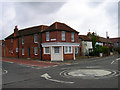


70 photos from this area
Area Information
Key information about the PO19 8HS including its size, population, and administrative classification.
- Area Type
- Postcode
- Area Size
- 2.5 hectares
- Population
- 1519
- Population Density
- 2316 people/km²
House Prices in PO19 8HS
9
Properties
£380,333
Average Sold Price
£150,000
Lowest Price
£760,000
Highest Price
Showing 9 properties
| Address | Type | Beds | Baths | Last Sale Price | Last Sale Date | |
|---|---|---|---|---|---|---|
| Flint Lodge, 70 Whyke Road, Chichester, PO19 8HS | Bungalow | - | - | £760,000 | Feb 2022 | |
| The Old Priests House, Whyke Road, Chichester, PO19 8HS | Semi-detached | - | - | £200,000 | Sep 2021 | |
| 73 Whyke Road, Chichester, PO19 8HS | house | - | - | £372,500 | Feb 2021 | |
| 71 Whyke Road, Chichester, PO19 8HS | house | 5 | - | £577,500 | Mar 2011 | |
| Sycamore Cottage, 48 Whyke Road, Chichester, PO19 8HS | Detached | 3 | 1 | £222,000 | Feb 2011 | |
| 49 Whyke Road, Chichester, PO19 8HS | house | 2 | 1 | £150,000 | Aug 2002 | |
| Whyke Cottage, Whyke Road, Chichester, PO19 8HS | Retail | 6 | 5 | - | - | |
| 50 Whyke Road, Chichester, PO19 8HS | house | - | - | - | - | |
| 72 Whyke Road, Chichester, PO19 8HS | Semi-detached | - | - | - | - |
Energy Efficiency in PO19 8HS
Amenities
Schools
| Rank | School | Type | Entry gender | Ages |
|---|
Explore more schools in this area
Go to Schools tabDemographics
Household Size
Two person
most common
Accommodation Type
Houses
most common
Tenure
76
majority
Ethnic Group
White
most common
Religion
N/A
most common
Household Composition
N/A
most common
Age
47
median
Adults (30-64 years)
most common
Household Deprivation
N/A
with no deprivation
NS-SEC
40
in Lower managerial occupations
Explore more demographic insights in this area
Go to Demographics tabPlanning
Planning Constraints
- Flood RiskPremium
- Ramsar Wetland SitesPremium
- Area of Outstanding Natural BeautyPremium
- Protected Nature ReservePremium
- Protected WoodlandPremium