Area Overview for PO19 7XU
Photos of PO19 7XU
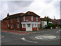
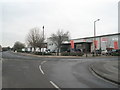
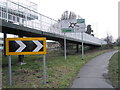
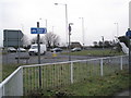
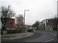

70 photos from this area
Area Information
Key information about the PO19 7XU including its size, population, and administrative classification.
- Area Type
- Postcode
- Area Size
- 7522 m²
- Population
- 1316
- Population Density
- 5486 people/km²
House Prices in PO19 7XU
35
Properties
£115,000
Average Sold Price
£27,950
Lowest Price
£166,000
Highest Price
Showing 35 properties
| Address | Type | Beds | Baths | Last Sale Price | Last Sale Date | |
|---|---|---|---|---|---|---|
| 3, Stephan Court, Chatsworth Road, Chichester, PO19 7XU | Flat | 1 | - | £151,500 | Dec 2024 | |
| 23 Chatsworth Road, Chichester, PO19 7XU | Flat | - | - | £158,000 | Aug 2024 | |
| 4 Chatsworth Road, Chichester, PO19 7XU | Flat | - | - | £132,000 | Mar 2024 | |
| 16 Chatsworth Road, Chichester, PO19 7XU | Flat | 1 | 1 | £110,000 | Jul 2023 | |
| 1 Chatsworth Road, Chichester, PO19 7XU | Flat | 1 | 1 | £160,000 | May 2023 | |
| 24 Chatsworth Road, Chichester, PO19 7XU | Flat | 1 | 1 | £166,000 | Nov 2022 | |
| 15 Chatsworth Road, Chichester, PO19 7XU | Flat | - | - | £140,000 | Jun 2021 | |
| 10, Norman Court, Chatsworth Road, Chichester, PO19 7XU | Flat | 1 | 1 | £113,000 | Feb 2021 | |
| 38, Philip Court, Chatsworth Road, Chichester, PO19 7XU | Flat | - | - | £127,500 | Nov 2020 | |
| 32, Philip Court, Chatsworth Road, Chichester, PO19 7XU | Flat | 1 | 1 | £121,500 | Sep 2020 |
Page 1 of 4
Energy Efficiency in PO19 7XU
Amenities
Schools
| Rank | School | Type | Entry gender | Ages |
|---|
Explore more schools in this area
Go to Schools tabDemographics
Household Size
Two person
most common
Accommodation Type
Houses
most common
Tenure
47
majority
Ethnic Group
White
most common
Religion
N/A
most common
Household Composition
N/A
most common
Age
47
median
Adults (30-64 years)
most common
Household Deprivation
N/A
with no deprivation
NS-SEC
32
in Lower managerial occupations
Explore more demographic insights in this area
Go to Demographics tabPlanning
Planning Constraints
- Flood RiskPremium
- Ramsar Wetland SitesPremium
- Area of Outstanding Natural BeautyPremium
- Protected Nature ReservePremium
- Protected WoodlandPremium