Area Overview for PO19 7EN
Photos of PO19 7EN
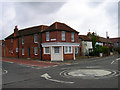
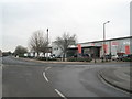
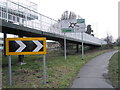
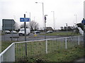
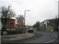

70 photos from this area
Area Information
Key information about the PO19 7EN including its size, population, and administrative classification.
- Area Type
- Postcode
- Area Size
- 9370 m²
- Population
- 1551
- Population Density
- 5119 people/km²
House Prices in PO19 7EN
36
Properties
£288,810
Average Sold Price
£72,000
Lowest Price
£810,000
Highest Price
Showing 36 properties
| Address | Type | Beds | Baths | Last Sale Price | Last Sale Date | |
|---|---|---|---|---|---|---|
| 29 Oving Road, Chichester, PO19 7EN | Terraced | 3 | 1 | £405,000 | Mar 2024 | |
| 59 Oving Road, Chichester, PO19 7EN | Semi-detached | 3 | 2 | £495,000 | Nov 2022 | |
| 48 Oving Road, Chichester, PO19 7EN | house | - | - | £291,000 | Aug 2022 | |
| 45 Oving Road, Chichester, PO19 7EN | house | 3 | 3 | £810,000 | Jun 2022 | |
| 30 Oving Road, Chichester, PO19 7EN | Terraced | 3 | 2 | £429,950 | Jun 2021 | |
| 57A Oving Road, Chichester, PO19 7EN | Flat | - | - | £185,000 | Oct 2020 | |
| 53 Oving Road, Chichester, PO19 7EN | Semi-detached | 3 | 2 | £345,000 | Mar 2020 | |
| 60 Oving Road, Chichester, PO19 7EN | Terraced | 2 | 1 | £370,000 | Dec 2019 | |
| 44 Oving Road, Chichester, PO19 7EN | Terraced | 2 | 1 | £295,000 | Apr 2017 | |
| 58 Oving Road, Chichester, PO19 7EN | Detached | 2 | 1 | £240,000 | Feb 2016 |
Page 1 of 4
Energy Efficiency in PO19 7EN
Amenities
Schools
| Rank | School | Type | Entry gender | Ages |
|---|
Explore more schools in this area
Go to Schools tabDemographics
Household Size
One person
most common
Accommodation Type
Houses
most common
Tenure
50
majority
Ethnic Group
White
most common
Religion
N/A
most common
Household Composition
N/A
most common
Age
47
median
Adults (30-64 years)
most common
Household Deprivation
N/A
with no deprivation
NS-SEC
36
in Lower managerial occupations
Explore more demographic insights in this area
Go to Demographics tabPlanning
Planning Constraints
- Flood RiskPremium
- Ramsar Wetland SitesPremium
- Area of Outstanding Natural BeautyPremium
- Protected Nature ReservePremium
- Protected WoodlandPremium