Area Overview for PO19 6SE
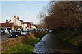
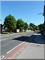
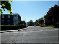
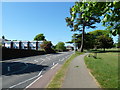
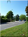
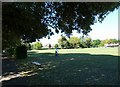
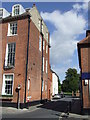
Photos of PO19 6SE


Area Information
Living in PO19 6SE offers a compact residential experience defined by density and specific postal boundaries. This postcode covers exactly 6.3 hectares, creating a close-knit cluster where neighbours are often within shouting distance. You will find a population of 1,802 residents living in this small footprint, resulting in a population density of 28,675 people per square kilometre. Such high density suggests a neighbourhood where everyone is aware of each other's presence, eliminating the isolation sometimes found in larger estates. Daily life here revolves around proximity; services and routes are immediate rather than requiring long commutes to reach your destination. The area functions as a tightly defined residential zone rather than a sprawling suburb, which appeals to those who value convenience over expansive green spaces. Your residence in this specific cluster places you in a defined community unit within the wider Chichester region, ensuring that local news and community events impact a relatively small group of people directly. This concentration means that local issues receive focused attention, and the sense of place remains distinct despite the broader urban context.
- Area Type
- Postcode
- Area Size
- 6.3 hectares
- Population
- 1802
- Population Density
- 2593 people/km²
Homes in PO19 6SE represent a market driven by ownership rather than rental investment. The data confirms that 62% of properties are owner-occupied, establishing this cluster as a solidly owned community. This statistic indicates that the housing stock primarily caters to people buying homes to live in, rather than landlords seeking high rental yields. You will find that houses form the backbone of this area, aligning with the preference for more substantial accommodation typically found in such high-density postcode clusters. Because the area is small, covering only 6.3 hectares, the housing market operates within a very limited local inventory. Buyers looking at this postcode are generally searching for a permanent base in a specific location. The low rental proportion means that transactional activity involves local movers as much as it does external investors. When viewing properties here, you are evaluating homes that serve residents who intend to stay for the foreseeable future. This market dynamic often supports consistent valuations based on community stability and local desirability rather than speculative trends.
House Prices in PO19 6SE
Showing 21 properties
Energy Efficiency in PO19 6SE
Daily life in PO19 6SE connects you to a range of retail and transport amenities within practical reach. You have access to five key businesses including The Southern Co-operative Co, Lidl Chichester, and Aldi Shopwyke. These retail outlets ensure you can purchase groceries and household essentials without needing to travel far. Your transport options extend to five railway stations, giving you flexibility for journeys across the coast. Chichester Railway Station, Fishbourne Railway Station, and Bosham Railway Station are all accessible, facilitating both local commutes and longer trips. If you require air travel, Chichester/Goodgood Airport stands as your nearest option. For coastal access, two ferry services operate from Bosham Hoe Ferry Landing and West Itchenor Ferry Landing. These facilities mean you can combine shopping trips with day trips to the South Coast. The concentration of these amenities supports a self-contained lifestyle where daily errands are completed locally. You can plan your week around the opening hours of The Southern Co-operative Co or the specific schedules of the nearby train stations. This blend of shopping and transport creates a functional environment that reduces reliance on long-distance travel for routine needs.
Amenities
Schools
Families considering schools near PO19 6SE have one immediate option listed in proximity to this postcode. Fordwater School in Chichester is the designated special school serving this neighbourhood. As a special education provision, it caters to specific learning needs that general mainstream schools do not address. This mix of school types means parents must ensure educational requirements match the available provisions carefully. There are no primary or secondary mainstream schools listed within the immediate data for this specific cluster, directing all families with special needs requirements toward this facility. If your child does not require special education, you would need to look beyond the immediate listed data to find suitable mainstream primary or secondary schools. The absence of other listed institutions highlights the uniqueness of this educational provision. Parents relocating here must verify transport routes and catchment areas to Chichester specifically. The presence of a special school suggests a supportive environment for diverse learning requirements, but families should confirm the specific scope of provision before making a final decision.
| Rank | School | Type | Entry gender | Ages |
|---|
Explore more schools in this area
Go to Schools tabDemographics
The community profile of PO19 6SE reflects a mature population with significant root establishment in the area. The median age is 47 years, driven predominantly by adults aged between 30 and 64. This age range indicates that the neighbourhood attracts families and empty nesters who have established careers rather than young students or retirees. Home ownership stands at 62%, meaning nearly two-thirds of households own their property outright or with a mortgage. This high rate of ownership correlates with the fact that the predominant accommodation type consists of houses, suggesting a stock built for permanence rather than transient renting. The area is chiefly populated by individuals of White ethnicity, providing a clear demographic identity for the cluster. With a high level of ownership and a mid-life age profile, you can expect a stable environment where long-term residents shape the character of the street. This demographic stability often translates to quieter streets during the day and a community that relies on established social networks rather than transient neighbours.
Household Size
Accommodation Type
Tenure
Ethnic Group
Religion
Household Composition
Age
Household Deprivation
NS-SEC
Explore more demographic insights in this area
Go to Demographics tabPlanning
Planning Constraints
- Flood RiskPremium
- Ramsar Wetland SitesPremium
- Area of Outstanding Natural BeautyPremium
- Protected Nature ReservePremium
- Protected WoodlandPremium