Area Overview for PO19 4XY
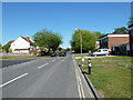
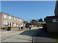
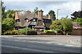
Photos of PO19 4XY


Area Information
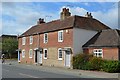
Living in PO19 4XY offers a settled, private residential experience within a specific postcode cluster in England. This small residential cluster is home to 1513 people, creating a compact neighbourhood that avoids the noise and crowds of larger towns. The environment is defined by a clear focus on housing, as the area consists almost entirely of houses rather than flats or other high-density accommodation types. Residents here enjoy a quiet existence where daily life centres on local habitats and proximity to regional travel hubs. The area is situated near practical transport nodes such as Chichester/Goodwood Airport and multiple railway stations including Chichester, Fishbourne, and Bosham. Ferry connections at Bosham Hoe and West Itchenor also provide direct water access, enhancing the lifestyle for those who value coastal routes. Despite its small population, PO19 4XY maintains strong links to wider services through five nearby retail outlets, primarily The Southern Co-operative Co. It is a place defined by ownership and stability. The community is established and familiar. Homebuyers should appreciate that this is a distinct, low-density pocket of England where residents prioritise ownership over renting and favour detached living over shared blocks.
- Area Type
- Postcode
- Area Size
- Not available
- Population
- 1513
- Population Density
- 2115 people/km²
The property market in PO19 4XY is characterised by a decisive lack of rental stock and a dominance of owner-occupied homes. With 89% home ownership, this area functions as a settled residential zone rather than a lettings market. Consequently, finding private rental properties here is highly unlikely compared to larger urban centres. The accommodation type is exclusively houses, indicating that the housing stock is designed for detached or semi-detached living rather than apartment blocks or terraced urban housing. For buyers, this structure means you are entering a market driven by long-term investment and family stability. Properties here are not typically flipped quickly by investors seeking rental yields. Instead, homes in PO19 4XY are held by residents who intend to stay for many years. This stability often results in well-maintained properties and a neighbourhood where local services reflect the needs of permanent families. You will not find the churn of a student quarter or a temporary worker hub. The focus is entirely on the homebuyer starting a family, selling a previous family home, or retiring from professional life. If you are looking for a buy-to-let strategy, this postcode will not support it. However, if you value the security of an owner-occupied community where neighbours have deep roots, this market offers exactly that environment without confusion or vacancy risks.
House Prices in PO19 4XY
No properties found in this postcode.
Energy Efficiency in PO19 4XY
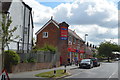
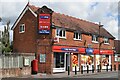
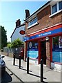
Life in PO19 4XY revolves around a blend of rural convenience and coastal access. Five retail outlets are located within practical reach, with The Southern Co-operative Co serving as the primary provisioning point for groceries and daily necessities. This ensures you do not need to travel far for basic shopping needs. Beyond retail, the area benefits from excellent transport links to scenic destinations. You can access Chichester/Goodwood Airport for private travel or utilise the railway network at Chichester, Fishbourne, and Bosham stations to reach larger towns and cities. The coastal aspect is a defining feature of your lifestyle here. Two ferry landings at Bosham Hoe and West Itchenor provide direct access to the water, allowing residents to travel by boat to nearby villages or enjoy day trips along the shoreline. This accessibility enhances the leisure experience without requiring a large car. While the area is quiet, it is not isolated. The presence of specific shopping venues and transport hubs means routine errands are manageable. You will find that shopping trips, school commutes to schools near Chichester or other local facilities, and weekend outings are all well supported by this infrastructure. The lifestyle is one of informed choice, where residents can opt for a quiet day in or a more active outing with minimal effort.
Amenities
Schools
| Rank | School | Type | Entry gender | Ages |
|---|
Explore more schools in this area
Go to Schools tabDemographics
The community in PO19 4XY is notable for its maturity and stability. The median age stands at 47 years, indicating a family-oriented environment rather than a student or young professional hub. The most common age range is elderly residents aged 65 years and over, suggesting the area appeals significantly to retirees or families with older children returning home. This age profile shapes the local pace and social dynamics. Home ownership is exceptionally high at 89%, meaning the vast majority of households have purchased their homes outright or have significant equity. This level of equity transfer typically reduces tenant turnover and fosters long-term community involvement. The area consists predominantly of houses, which aligns with the older demographic profile and high ownership rates. The predominant ethnic group is White, reflecting the traditional settlement patterns common in established rural English clusters. You can expect a neighbourly atmosphere where residents have known each other for decades. The concentration of older residents means services are geared towards established families rather than transient populations. The high rate of home ownership also implies that property values remain stable, as owners are less likely to move frequently compared to renters. This demographic structure creates a predictable, low-pressure environment for new buyers seeking a quiet retirement or a family home away from the rush of urban centres.
Household Size
Accommodation Type
Tenure
Ethnic Group
Religion
Household Composition
Age
Household Deprivation
NS-SEC
Explore more demographic insights in this area
Go to Demographics tabPlanning
Planning Constraints
- Flood RiskPremium
- Ramsar Wetland SitesPremium
- Area of Outstanding Natural BeautyPremium
- Protected Nature ReservePremium
- Protected WoodlandPremium