Area Overview for PO19 1NL
Photos of PO19 1NL
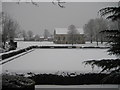
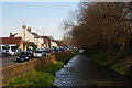
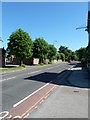

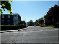
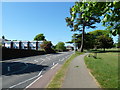
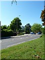
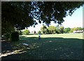
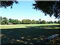
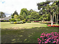
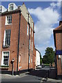
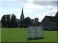
100 photos from this area
Area Information
Key information about the PO19 1NL including its size, population, and administrative classification.
- Area Type
- Postcode
- Area Size
- 1.6 hectares
- Population
- 1843
- Population Density
- 2924 people/km²
House Prices in PO19 1NL
12
Properties
£409,250
Average Sold Price
£377,500
Lowest Price
£441,000
Highest Price
Showing 12 properties
| Address | Type | Beds | Baths | Last Sale Price | Last Sale Date | |
|---|---|---|---|---|---|---|
| 4 Priory Lane, Chichester, PO19 1NL | house | - | - | £377,500 | Mar 2024 | |
| 2, Priory Mews, Priory Lane, Chichester, PO19 1NL | Terraced | 3 | 2 | £441,000 | Oct 2006 | |
| 2 Priory Lane, Chichester, PO19 1NL | Terraced | 3 | - | - | - | |
| 1, Priory Mews, Priory Lane, Chichester, PO19 1NL | Terraced | 3 | 3 | - | - | |
| 3, Priory Mews, Priory Lane, Chichester, PO19 1NL | Terraced | 3 | 3 | - | - | |
| Priory Lodge, Priory Lane, Chichester, PO19 1NL | Terraced | 3 | 2 | - | - | |
| The Guildhall, Priory Park, Priory Lane, Chichester, PO19 1NL | commercial | - | - | - | - | |
| Fenwicks Cafe, Priory Park, Priory Lane, Chichester, PO19 1NL | Restaurant | - | - | - | - | |
| 3 Priory Lane, Chichester, PO19 1NL | undefined | - | - | - | - | |
| Chichester Bowling Club, The Pavilion, Priory Lane, Chichester, PO19 1NL | assembly_leisure | - | - | - | - |
Page 1 of 2
Energy Efficiency in PO19 1NL
Amenities
Schools
| Rank | School | Type | Entry gender | Ages |
|---|
Explore more schools in this area
Go to Schools tabDemographics
Household Size
One person
most common
Accommodation Type
Houses
most common
Tenure
56
majority
Ethnic Group
White
most common
Religion
N/A
most common
Household Composition
N/A
most common
Age
47
median
Young Adults (15-29 years)
most common
Household Deprivation
N/A
with no deprivation
NS-SEC
36
in Lower managerial occupations
Explore more demographic insights in this area
Go to Demographics tabPlanning
Planning Constraints
- Flood RiskPremium
- Ramsar Wetland SitesPremium
- Area of Outstanding Natural BeautyPremium
- Protected Nature ReservePremium
- Protected WoodlandPremium