Area Overview for PO19 1BT
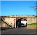
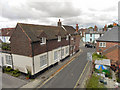
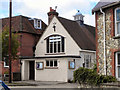
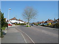
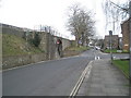
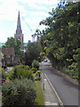
Photos of PO19 1BT


Area Information
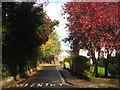
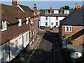
Living in PO19 1BT offers a specific snapshot of residential life within a small cluster characterised by high population density. This postcode area accommodates 2,370 people across a compact footprint, resulting in a density of 1,927 people per square kilometre. Such concentration creates an environment where services are central and neighbours are close by, though the lack of space data prevents a discussion on land area. The location sits just off the main road in Chichester, placing it within practical reach of the town centre and its surrounding coast. Residents here benefit from immediate access to historic towns, coastal paths, and rural hinterlands without needing to travel far for daily essentials. The area functions as a residential hub that balances urban convenience with proximity to the wider South Downs National Park. You will find yourself situated in a community where the rhythm of daily life is dictated by local transport links and the immediate availability of retail and leisure options. The distinct nature of PO19 1BT lies in its function as a dense residential node that connects directly to the broader Chichester infrastructure while maintaining its own residential identity.
- Area Type
- Postcode
- Area Size
- Not available
- Population
- 2370
- Population Density
- 1927 people/km²
The property market in PO19 1BT is distinctly characterised by high-density living, with flats serving as the predominant accommodation type. This stock profile means that buyers looking for traditional semi-detached or detached houses must look beyond this specific postcode or consider the immediate surrounding streets. With home ownership standing at 57%, the area leans towards owner-occupation, suggesting that many residents have a tangible stake in the local community and property values. However, the concentration of flats implies a significant rental sector, potentially catering to professionals or students attracted to the nearby independent schools and university facilities. Living in this specific cluster means navigating a market defined by vertical rather than horizontal living space. Properties here offer immediate access to town amenities, but the floor plan and density of flats differ significantly from suburban or rural housing. If you are considering homes in PO19 1BT, you are entering a market where space efficiency is often prioritised over land size, reflecting the tight population packing of 1,927 people per square kilometre.
House Prices in PO19 1BT
Showing 4 properties
| Address | Type | Beds | Baths | Last Sale Price | Last Sale Date | |
|---|---|---|---|---|---|---|
| 25A Chapel Street, Chichester, PO19 1BT | Flat | 3 | 1 | - | - | |
| 25C Chapel Street, Chichester, PO19 1BT | Flat | 3 | 1 | - | - | |
| 25 Chapel Street, Chichester, PO19 1BT | Flat | 3 | 1 | - | - | |
| 25B Chapel Street, Chichester, PO19 1BT | Flat | - | - | - | - |
Energy Efficiency in PO19 1BT
Your daily life in PO19 1BT benefits from immediate access to a wide range of essential and leisure services. Retail options are well represented with five notable outlets, including M&S Chichester and Iceland Chichester, ensuring you do not need to travel far for staples or clothing. Five railway stations are also within practical reach, specifically Chichester Railway Station, Fishbourne Railway Station, and Bosham Railway Station, providing comprehensive rail links to Brighton, London, and the south coast. For those preferring air travel or charter flights, another airport is available at Chichester/Goodwood Airport. Water users have convenient ferry access via the Bosham Hoe Ferry Landing and West Itchenor Ferry Landing, offering scenic routes to other coastal towns. These amenities create a lifestyle where you can live in a dense residential cluster while enjoying the breadth of a larger town and its coastal surroundings. The variety of transport modes means you can configure your daily journey based on whether you need speed, cost-effectiveness, or a seaside escape.
Amenities
Schools
Families in PO19 1BT have several educational options within practical reach, ranging from state-funded primary to independent institutions and sixth forms. St Richard's Catholic Primary School holds a 'Good' Ofsted rating and serves local children in the state sector. For those preferring an independent education, Northgate House School and The Prebendal School are both located nearby and do not currently have Ofsted ratings listed in available records. The Prebendal School is specifically recognised for its Girls' Department, offering bilingual education. Older students have access to Chichester College Group, which provides sixth-form education. This variety allows parents to choose between the structured environment of rated state primary education or the private sector offerings of Northgate House and The Prebendal School. The presence of a dedicated sixth-form college indicates that the area supports education up to age 18. You will not find any faith schools listed with green band ratings in the immediate cluster, but the notable presence of Catholic and Independent institutions suggests a diverse educational ethos available to children growing up in PO19 1BT.
| Rank | School | Type | Entry gender | Ages |
|---|
Explore more schools in this area
Go to Schools tabDemographics
The community in PO19 1BT is defined by a significant presence of established homeowners, with 57% of households in the area owning their properties outright or through mortgage. This majority ownership statistic suggests a stable neighbourhood where long-term residents value local investment. Despite the higher age median of 47 years, the most common age range recorded for the demographic profile falls within 15 to 29 years. This apparent gap between the median age and the most common age group indicates a complex household structure, potentially involving many working-age adults living alone or with young children. White residents form the predominant ethnic group in the area. The dominant accommodation type is flats, which aligns with the high-density nature of the postcode. You are looking at an area where a mix of older families and younger professionals coexist in predominantly flat dwellings. The high density means life moves at a quicker pace than in more spread-out rural hamlets.
Household Size
Accommodation Type
Tenure
Ethnic Group
Religion
Household Composition
Age
Household Deprivation
NS-SEC
Explore more demographic insights in this area
Go to Demographics tabPlanning
Planning Constraints
- Flood RiskPremium
- Ramsar Wetland SitesPremium
- Area of Outstanding Natural BeautyPremium
- Protected Nature ReservePremium
- Protected WoodlandPremium