Area Overview for PO19 1AD
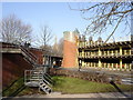
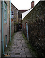
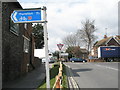
Photos of PO19 1AD


Area Information
PO19 1AD represents a specific postcode area covering a small residential cluster in England. It houses a population of 2,370 people within a compact footprint, resulting in a high population density of 1,927 people per square kilometre. This tight clustering defines the local character, creating a neighbourhood where proximity between homes is significant. Living in PO19 1AD means navigating an environment where every space is utilised and residents likely know their immediate neighbours well due to the limited street network. The area functions as a focused residential hub rather than a sprawling suburb. You will find that the built environment is intense and continuous, reflecting the underlying geography of this small pocket. Daily life here revolves around the immediate street pattern, as there is little room for large independent gardens or wide communal spaces. The density dictates the rhythm of the community, fostering close daily interactions but also reducing the scope for private retreat within the property itself. Understanding the scale of this postcode is essential before considering a move to PO19 1AD.
- Area Type
- Postcode
- Area Size
- Not available
- Population
- 2370
- Population Density
- 1927 people/km²
The property market in PO19 1AD is defined by the characteristics of its housing stock and ownership patterns. With 57% home ownership, the area leans towards owner-occupiers who have chosen to settle here long term. However, the prominence of flats as the primary accommodation type indicates that much of the housing stock in PO19 1AD consists of smaller, shared units rather than detached houses. This configuration supports a high population density of 1,927 people per square kilometre, as compact living allows more households to reside within the same geographical boundary. For buyers looking at this small area, the market is likely dominated by second-hand flats or properties adapted for high-density living. You should expect limited space for exterior gardens or private areas due to the nature of the buildings. The concentration of flats also means that sound insulation and building regulations are critical factors when viewing homes in PO19 1AD. The mix of owned and rented properties suggests a stable community where leases and market prices are closely monitored. Understanding that most homes are flats helps set realistic expectations regarding maintenance and communal aspects of living in this postcode.
House Prices in PO19 1AD
No properties found in this postcode.
Energy Efficiency in PO19 1AD
Residents of PO19 1AD benefit from a range of convenient amenities located within practical reach. Five retail outlets are situated nearby, including major chains such as M&S Chichester and Iceland Chichester. These shops provide essential groceries and clothing needs without the necessity of long journeys. Transport links are well integrated, with five rail options available. Chichester Railway Station, Fishbourne Railway Station, and Bosham Railway Station are all within easy access, allowing easy commute or travel plans. For aviation needs, Chichester/Goodwood Airport serves the area with one airstrip facility. Water connections are supported by two ferry landings, specifically Bosham Hoe Ferry Landing and West Itchenor Ferry Landing. These options connect PO19 1AD to coastal locations and enhance local leisure activities. The presence of these specific venues means your daily errands, commutes, and holidays can begin quickly. Living in PO19 1AD places you close to significant retail and transport hubs that reduce reliance on cars for basic tasks.
Amenities
Schools
Families in PO19 1AD have access to several educational institutions within a practical reach of the neighbourhood. St Richard's Catholic Primary School is located nearby and holds a Ofsted rating of good. This rating provides assurance for parents seeking a standard of education that meets regulatory expectations. For children outside the state sector or seeking different curricula, independent options are available. Northgate House School and The Prebendal School are both independent institutions located near PO19 1AD. These choices offer flexibility for families who prioritise faith-based education or specialised learning environments. For older students transitioning from secondary education, Chichester College Group serves as a sixth-form institution in the vicinity. The availability of a good-rated primary school alongside multiple independent and higher education options means that living in PO19 1AD offers diverse educational pathways. You can select between state, private, and further education providers without needing to travel far from your home in this postcode.
| Rank | School | Type | Entry gender | Ages |
|---|
Explore more schools in this area
Go to Schools tabDemographics
The community within PO19 1AD displays a distinct demographic profile shaped by its residential nature. The median age stands at 47 years, suggesting a mature population that has settled in the area over time. Despite the higher median age, the most common age range is young adults aged 15 to 29 years. This demographic mix indicates that while the average resident is older, there is a notable presence of younger families or individuals. Home ownership creates stability in the area, with 57% of residents owning their homes outright or through a mortgage. The remaining population likely resides in rented accommodation, contributing to a mixed yet stable neighbourhood. Flats form the predominant accommodation type in PO19 1AD, which aligns with the high population density of 1,927 people per square kilometre. This suggests the housing stock prioritises efficiency and shared living spaces over sprawling family homes. The predominant ethnic group recorded in the area is White, reflecting the broader demographic trends of the region. Every claim regarding the community size reflects the specific population figure of 2,370 recorded for this postcode.
Household Size
Accommodation Type
Tenure
Ethnic Group
Religion
Household Composition
Age
Household Deprivation
NS-SEC
Explore more demographic insights in this area
Go to Demographics tabPlanning
Planning Constraints
- Flood RiskPremium
- Ramsar Wetland SitesPremium
- Area of Outstanding Natural BeautyPremium
- Protected Nature ReservePremium
- Protected WoodlandPremium