Area Overview for PO19 1AA
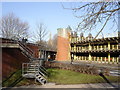
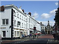
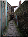
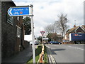
Photos of PO19 1AA


Area Information
Living in PO19 1AA defines a specific residential experience within a tightly clustered neighbourhood. This postcode covers an area of 2913 square metres and serves a population of 2370 people. The density reaches 1927 people per square kilometre, creating a concentrated living environment where neighbours are close at hand. You are located in a defined cluster that forms part of the broader PO19 region. Daily life here revolves around a shared space where residents interact frequently due to the high population density. The area functions as a distinct pocket within the South Downs, blending residential calm with urban accessibility. You will experience a community where every household is neighbours to another. The physical space is limited, yet it supports a significant number of residents through efficient planning. This compact nature offers convenience but requires adaptation to close quarters. Your morning commute or evening walk takes place within this immediate circle of homes. The area stands out for its specific footprint and resident count rather than extensive land. You live amidst a group where privacy might be more limited than in sprawling suburbs. The character of PO19 1AA is shaped by these hard limits on space and the strength of local ties.
- Area Type
- Postcode
- Area Size
- 2913 m²
- Population
- 2370
- Population Density
- 1927 people/km²
The property market in PO19 1AA is defined by a 57% home ownership rate, distinguishing it as a mixed but predominantly owner-occupied zone. Flats constitute the main accommodation type, indicating that you will primarily encounter multi-storey dwellings or self-contained units within this 2913 square metre area. This housing stock suggests a vertical living solution rather than large detached houses. Buyers should expect a market where ownership is common, yet the form of homes adapts to density constraints. The 2370 population spread across this small footprint means supply is finite. You might find more competition for specific units within the flat complexes than you would in a broader postcode district. The high population density of 1927 people per square kilometre reinforces the reliance on flats for efficient land use. If you seek a rental property, the 43% non-ownership segment offers opportunities, though inventory is limited by the total area size. The market is not driven by vast estates but by specific clusters of housing. Your options remain focused on the types of dwellings that fit within the existing built environment. Property values here reflect the constraint of space rather than the generosity of acreage.
House Prices in PO19 1AA
No properties found in this postcode.
Energy Efficiency in PO19 1AA
Residents of PO19 1AA enjoy convenient access to essential amenities within practical reach. Local shopping is handled by major chains including Waitrose Chichester, Tesco Chichester, and Iceland Chichester. These retail outlets cover daily grocery needs and general household requirements. Travelers can access rail connections via Chichester Railway Station, Fishbourne Railway Station, and Bosham Railway Station. These five stations offer various options for regional and national journeys. For aviation, Chichester/Goodwood Airport provides a nearby aerial option. Those wishing to explore the coastline can use the ferry services at Bosham Hoe Ferry Landing and West Itchenor Ferry Landing. These two ferries offer regular crossings to explore the South Coast villages. The combination of supermarkets, multiple railway hubs, and ferry landings creates a robust network of daily conveniences. You do not need to travel far for basic supplies or cross-country trips. The location supports a lifestyle that balances local errands with regional exploration. Dining and leisure options in Chichester are a short drive away.
Amenities
Schools
Families in PO19 1AA have access to a selection of educational institutions nearby. St Richard's Catholic Primary School operates as a primary academy with a Good Ofsted rating. This setting offers statutory education standards for younger children. For those seeking alternative provisions, Northgate House School and The Prebendal School serve as independent options. These institutions provide flexible curricula outside the state system. Chichester College Group functions as a sixth-form college, supporting students in their final years of education. The presence of an independent primary school and two independent colleges gives residents diverse educational pathways. You can choose between the maintained good-rating of St Richard's or the bespoke environment of the independent schools. The mix suggests that families value choice when selecting educational settings for their children. Distance to schools remains a practical consideration given the postcode's proximity to Chichester. The variety of school types means that community life includes a range of educational philosophies and teaching methods. Parents in the area benefit from this proximity to multiple regulated educational centres.
| Rank | School | Type | Entry gender | Ages |
|---|
Explore more schools in this area
Go to Schools tabDemographics
The community in PO19 1AA shows a median age of 47 years, indicating a largely mature population. Despite this median figure, Young Adults between 15 and 29 years represent the most common age range. This suggests a dynamic mix where families and couples coexist with younger tenants or new homeowners. Home ownership stands at 57%, meaning nearly six out of ten residents own their property outright or with a mortgage. The remaining 43% likely rent, reflecting a balance of stability and transient living. Flats are the predominant accommodation type, shaping how space is utilised within the 2913 square metre zone. The predominant ethnic group is White, reflecting the established demographic history of the locality. These figures paint a picture of a neighbourhood with traditional family structures alongside younger professionals. The 57% ownership rate signals a desire for long-term security among many residents. You will encounter a population that values stability yet welcomes new energy into the streets. The age distribution ensures that local services cater to both retirees and families with children. Living here means engaging with a society that spans multiple generations under one postcode. The coexistence of older residents and young adults creates a unique social rhythm in this high-density cluster.
Household Size
Accommodation Type
Tenure
Ethnic Group
Religion
Household Composition
Age
Household Deprivation
NS-SEC
Explore more demographic insights in this area
Go to Demographics tabPlanning
Planning Constraints
- Flood RiskPremium
- Ramsar Wetland SitesPremium
- Area of Outstanding Natural BeautyPremium
- Protected Nature ReservePremium
- Protected WoodlandPremium