Area Overview for PO18 8ET
Photos of PO18 8ET
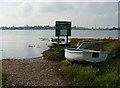
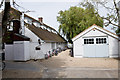
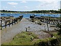
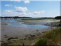
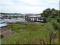
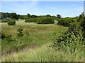
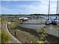
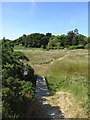
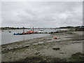
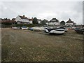
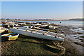
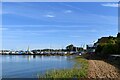
60 photos from this area
Area Information
Key information about the PO18 8ET including its size, population, and administrative classification.
- Area Type
- Postcode
- Area Size
- 53.9 hectares
- Population
- 1578
- Population Density
- 195 people/km²
House Prices in PO18 8ET
31
Properties
£1,439,107
Average Sold Price
£435,000
Lowest Price
£3,290,000
Highest Price
Showing 31 properties
| Address | Type | Beds | Baths | Last Sale Price | Last Sale Date | |
|---|---|---|---|---|---|---|
| Shearwater, Bosham Hoe, Bosham, PO18 8ET | house | - | - | £2,500,000 | Mar 2025 | |
| Moonbeam, Bosham Hoe, Bosham, PO18 8ET | Detached | 4 | - | £2,450,000 | Jun 2023 | |
| Coppice Field, Bosham Hoe, Bosham, PO18 8ET | house | 5 | 4 | £3,290,000 | Oct 2022 | |
| Wealdens, Bosham Hoe, Bosham, PO18 8ET | house | - | - | £1,650,000 | Jan 2021 | |
| Spindrift House, Bosham Hoe, Bosham, PO18 8ET | Detached | 6 | 3 | £1,855,000 | Oct 2020 | |
| The Soundings, Bosham Hoe, Bosham, PO18 8ET | house | - | - | £1,425,000 | Feb 2017 | |
| Hoe Corner, Bosham Hoe, Bosham, PO18 8ET | house | - | - | £940,000 | Jan 2013 | |
| Inner Randells, Bosham Hoe, Bosham, PO18 8ET | house | - | - | £745,000 | Jun 2006 | |
| Furzefield Cottage, Bosham Hoe, Bosham, PO18 8ET | house | - | - | £1,805,000 | Aug 2005 | |
| Crabbers, Bosham Hoe, Bosham, PO18 8ET | Detached | 5 | 2 | £730,000 | Apr 2003 |
Page 1 of 4
Energy Efficiency in PO18 8ET
Amenities
Schools
| Rank | School | Type | Entry gender | Ages |
|---|
Explore more schools in this area
Go to Schools tabDemographics
Household Size
Two person
most common
Accommodation Type
Houses
most common
Tenure
78
majority
Ethnic Group
White
most common
Religion
N/A
most common
Household Composition
N/A
most common
Age
47
median
Adults (30-64 years)
most common
Household Deprivation
N/A
with no deprivation
NS-SEC
54
in Lower managerial occupations
Explore more demographic insights in this area
Go to Demographics tabPlanning
Planning Constraints
- Flood RiskPremium
- Ramsar Wetland SitesPremium
- Area of Outstanding Natural BeautyPremium
- Protected Nature ReservePremium
- Protected WoodlandPremium