Area Overview for PO18 0EX
Photos of PO18 0EX
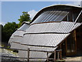
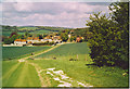
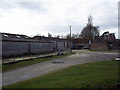
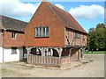
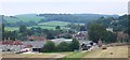
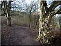
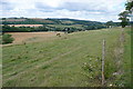
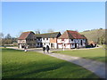
100 photos from this area
Area Information
Key information about the PO18 0EX including its size, population, and administrative classification.
- Area Type
- Postcode
- Area Size
- 29.4 hectares
- Population
- 2243
- Population Density
- 27 people/km²
House Prices in PO18 0EX
18
Properties
£585,091
Average Sold Price
£95,000
Lowest Price
£1,200,000
Highest Price
Showing 18 properties
| Address | Type | Beds | Baths | Last Sale Price | Last Sale Date | |
|---|---|---|---|---|---|---|
| Sunnyhurst, Paddock Lane, Singleton, PO18 0EX | house | - | - | £535,000 | Jun 2022 | |
| Grove Cottage, A 286 Town Lane To The Grove, Singleton, PO18 0EX | Detached | 4 | 2 | £725,000 | Jun 2021 | |
| Cowper Lodge, A 286 Cobblers Row To Middlefield, Singleton, PO18 0EX | Detached | 6 | 2 | £760,000 | Jun 2018 | |
| Flambards, A 286 The Grove To Cobblers Row, Singleton, PO18 0EX | house | - | - | £1,200,000 | Jan 2017 | |
| The Coach House, A 286 The Grove To Cobblers Row, Singleton, PO18 0EX | house | - | - | £650,000 | Jun 2016 | |
| Flint Lodge, Paddock Lane, Singleton, PO18 0EX | house | - | - | £980,000 | Aug 2014 | |
| Brook Cottage, Paddock Lane, Singleton, PO18 0EX | Detached | 4 | - | £472,000 | Mar 2013 | |
| Brook House, A 286 The Grove To Cobblers Row, Singleton, PO18 0EX | Detached | - | - | £570,000 | Apr 2005 | |
| Brightside, A 286 Town Lane To The Grove, Singleton, PO18 0EX | Retail | 2 | 1 | £164,000 | Apr 2000 | |
| Little Owls, A 286 The Grove To Cobblers Row, Singleton, PO18 0EX | Detached | - | - | £95,000 | Jun 1998 |
Page 1 of 2
Energy Efficiency in PO18 0EX
Amenities
Schools
| Rank | School | Type | Entry gender | Ages |
|---|
Explore more schools in this area
Go to Schools tabDemographics
Household Size
Two person
most common
Accommodation Type
Houses
most common
Tenure
55
majority
Ethnic Group
White
most common
Religion
N/A
most common
Household Composition
N/A
most common
Age
47
median
Adults (30-64 years)
most common
Household Deprivation
N/A
with no deprivation
NS-SEC
37
in Lower managerial occupations
Explore more demographic insights in this area
Go to Demographics tabPlanning
Planning Constraints
- Flood RiskPremium
- Ramsar Wetland SitesPremium
- Area of Outstanding Natural BeautyPremium
- Protected Nature ReservePremium
- Protected WoodlandPremium