Area Overview for PO17 6JR
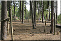
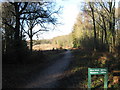
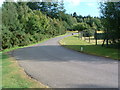
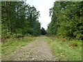
Photos of PO17 6JR


Area Information
Living in PO17 6JR offers a quiet residential experience within a specific postcode cluster covering 50.0 hectares. This small area is home to 1,257 residents, resulting in a population density of 85 people per square kilometre. You will find a compact environment that feels detached from the intensity of larger urban centres. The setting is defined by its size and intimate scale, which shapes the rhythm of daily life for everyone here. Proximity to local hubs remains manageable without the congestion found in denser towns. The area serves as a distinct residential pocket where space and community coexist. Residents benefit from a layout that prioritises living space over high-rise intensity. The geography supports a lifestyle centred on local access rather than long commutes through crowded thoroughfares. For those considering this location, the modest footprint ensures a peaceful atmosphere. Every square kilometre holds a defined portion of the total population. The character of PO17 6JR is built on this manageable density. You gain immediate access to essential services while retaining a secluded feel. The balance between isolation and convenience defines the experience of this specific postcode. This environment suits those who value a contained, low-density home setting. The 50-hectare boundary clearly demarcates the limits of this residential zone.
- Area Type
- Postcode
- Area Size
- 50.0 hectares
- Population
- 1257
- Population Density
- 85 people/km²
The property market in PO17 6JR is characterised by a strong preference for ownership. Eighty-eight per cent of households here own their homes. This figure is significantly higher than the national average for the UK. The accommodation type in this postcode is exclusively houses. You will search primarily for detached or semi-detached dwellings rather than purpose-built flats. This concentration of housing types shapes the available inventory for buyers. The area does not support a large rental sector because of the high ownership rate. Prospective buyers should expect to compete in a market where sellers often have equity tied up in properties. The lack of flats means options are limited to traditional family homes. This consistency in property type appeals to families seeking space. However, the market may suffer from a lack of variety in architectural styles. Buyers looking for modern conversions or purpose-built blocks will find none here. The 88% ownership rate also implies lower churn in the housing stock. Properties tend to remain with the same families for extended periods. This stability can lead to slower-moving sales cycles for homeowners. When you look at homes in PO17 6JR, you are looking at a settled market. The dominance of houses means that prices reflect land and space values. You should prepare for a transaction typical of owner-occupied neighbourhoods.
House Prices in PO17 6JR
No properties found in this postcode.
Energy Efficiency in PO17 6JR
Amenities
Schools
Families relying on education will find Newtown Soberton Infant School nearby. This establishment is listed as a primary school. The Ofsted rating for Newtown Soberton Infant School is good. This rating certifies the school's standards in education and behaviour. While data for secondary schools is absent from the current records, the infant school provides early education for local children. This single primary option suggests that older children may need to travel to schools outside the immediate vicinity. The presence of a good-rated infant school supports families with younger children attending reception through Year 2 or 3. You cannot determine the number of secondary options or their specific locations from the available information. However, the proximity to a reputable primary school adds value to local properties. Parents often prioritise the quality rating when selecting a school catchment area. The good rating of Newtown Soberton Infant School is a concrete asset for residents. If your children are at the early stages of their education, this nearby facility is a key resource. The school serves the immediate neighbourhood directly. Families should plan ahead for transitions to secondary education based on local boundary arrangements. The limited school data highlights the need to verify secondary options separately.
| Rank | School | Type | Entry gender | Ages |
|---|
Explore more schools in this area
Go to Schools tabDemographics
The community in PO17 6JR is predominantly composed of adults aged between 30 and 64 years. Your median age is 47 years, reflecting a mature population structure. Home ownership stands at a high level of 88 per cent. This statistic indicates that the vast majority of households in this area own their residences outright or with a mortgage. The area consists almost entirely of houses, with no significant presence of flats or apartments. Ethnic diversity is limited, as the predominant ethnic group is White. These figures paint a picture of a stable, established community with long-term residents. The high ownership rate suggests that people buy to stay rather than rent transiently. Families with school-age children or retirees looking for stability likely form a large portion of the demographic. The age profile supports local businesses that cater to working professionals and those nearing retirement. You will not find a transient student population or a high volume of short-term tenants. The housing stock reflects a commitment to the locality. This demographic makeup influences the pace of life and the types of social interactions you might observe. Neighbours have likely lived here for many years, creating deep-rooted local connections.
Household Size
Accommodation Type
Tenure
Ethnic Group
Religion
Household Composition
Age
Household Deprivation
NS-SEC
Explore more demographic insights in this area
Go to Demographics tabPlanning
Planning Constraints
- Flood RiskPremium
- Ramsar Wetland SitesPremium
- Area of Outstanding Natural BeautyPremium
- Protected Nature ReservePremium
- Protected WoodlandPremium