Area Overview for PO17 6JH
Photos of PO17 6JH
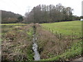
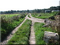
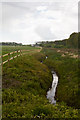
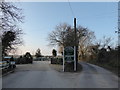
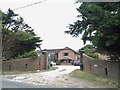
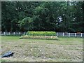

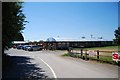
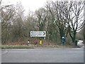
12 photos from this area
Area Information
Key information about the PO17 6JH including its size, population, and administrative classification.
- Area Type
- Postcode
- Area Size
- 26.0 hectares
- Population
- 1834
- Population Density
- 63 people/km²
House Prices in PO17 6JH
23
Properties
£1,062,500
Average Sold Price
£307,500
Lowest Price
£2,999,999
Highest Price
Showing 23 properties
| Address | Type | Beds | Baths | Last Sale Price | Last Sale Date | |
|---|---|---|---|---|---|---|
| The House, Southwick Road, North Boarhunt, PO17 6JH | house | - | - | £2,999,999 | Jul 2023 | |
| Mount Folly House, Southwick Road, North Boarhunt, PO17 6JH | Detached | 4 | 2 | £1,100,000 | Mar 2017 | |
| Rowndale, Southwick Road, North Boarhunt, PO17 6JH | Chalet | 5 | 2 | £485,000 | Jan 2014 | |
| Glenthorne, Southwick Road, North Boarhunt, PO17 6JH | Bungalow | 3 | - | £420,000 | May 2013 | |
| Willow Lodge, Southwick Road, North Boarhunt, PO17 6JH | Detached | 5 | 2 | £307,500 | Jun 2000 | |
| Merryvale, Southwick Road, North Boarhunt, PO17 6JH | Bungalow | 3 | 2 | - | - | |
| Winston, Southwick Road, North Boarhunt, PO17 6JH | Land | 2 | - | - | - | |
| Mobile Home At Rear Of, The Bungalow, Southwick Road, North Boarhunt, PO17 6JH | Mobile Home | - | - | - | - | |
| Burrenlea Cottage, Southwick Road, North Boarhunt, PO17 6JH | Bungalow | 2 | - | - | - | |
| Office, Mount Folly Farm, Southwick Road, North Boarhunt, PO17 6JH | Office | - | - | - | - |
Page 1 of 3
Energy Efficiency in PO17 6JH
Amenities
Schools
| Rank | School | Type | Entry gender | Ages |
|---|
Explore more schools in this area
Go to Schools tabDemographics
Household Size
Two person
most common
Accommodation Type
Houses
most common
Tenure
52
majority
Ethnic Group
White
most common
Religion
N/A
most common
Household Composition
N/A
most common
Age
47
median
Adults (30-64 years)
most common
Household Deprivation
N/A
with no deprivation
NS-SEC
41
in Lower managerial occupations
Explore more demographic insights in this area
Go to Demographics tabPlanning
Planning Constraints
- Flood RiskPremium
- Ramsar Wetland SitesPremium
- Area of Outstanding Natural BeautyPremium
- Protected Nature ReservePremium
- Protected WoodlandPremium