Area Overview for PO17 5GB
Photos of PO17 5GB
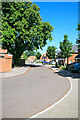
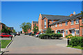
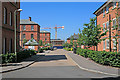
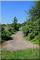
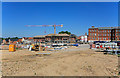
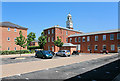
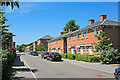
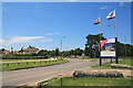
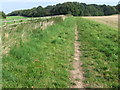
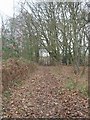
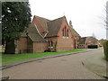
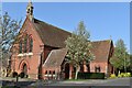
41 photos from this area
Area Information
Key information about the PO17 5GB including its size, population, and administrative classification.
- Area Type
- Postcode
- Area Size
- 5607 m²
- Population
- 1487
- Population Density
- 867 people/km²
House Prices in PO17 5GB
19
Properties
£299,295
Average Sold Price
£202,500
Lowest Price
£430,000
Highest Price
Showing 19 properties
| Address | Type | Beds | Baths | Last Sale Price | Last Sale Date | |
|---|---|---|---|---|---|---|
| 63 Boundary Walk, Knowle, PO17 5GB | Detached | 4 | 3 | £425,000 | Mar 2025 | |
| 61 Boundary Walk, Knowle, PO17 5GB | Detached | 4 | 3 | £430,000 | Sep 2024 | |
| 81 Boundary Walk, Knowle, PO17 5GB | house | - | - | £281,340 | Mar 2022 | |
| 82 Boundary Walk, Knowle, PO17 5GB | Terraced | 4 | 2 | £325,000 | Sep 2021 | |
| 86 Boundary Walk, Knowle, PO17 5GB | Terraced | 3 | 1 | £254,000 | Dec 2017 | |
| 83 Boundary Walk, Knowle, PO17 5GB | Terraced | 3 | - | £263,000 | May 2017 | |
| 84 Boundary Walk, Knowle, PO17 5GB | Terraced | 3 | 1 | £249,000 | Aug 2016 | |
| 67 Boundary Walk, Knowle, PO17 5GB | house | 5 | - | £371,000 | Mar 2016 | |
| 65 Boundary Walk, Knowle, PO17 5GB | Detached | 4 | 2 | £335,000 | Sep 2014 | |
| 88 Boundary Walk, Knowle, PO17 5GB | house | - | - | £205,000 | Oct 2011 |
Page 1 of 2
Energy Efficiency in PO17 5GB
Amenities
Schools
| Rank | School | Type | Entry gender | Ages |
|---|
Explore more schools in this area
Go to Schools tabDemographics
Household Size
Two person
most common
Accommodation Type
Houses
most common
Tenure
58
majority
Ethnic Group
White
most common
Religion
N/A
most common
Household Composition
N/A
most common
Age
47
median
Adults (30-64 years)
most common
Household Deprivation
N/A
with no deprivation
NS-SEC
48
in Lower managerial occupations
Explore more demographic insights in this area
Go to Demographics tabPlanning
Planning Constraints
- Flood RiskPremium
- Ramsar Wetland SitesPremium
- Area of Outstanding Natural BeautyPremium
- Protected Nature ReservePremium
- Protected WoodlandPremium