Area Overview for PO17 5BL
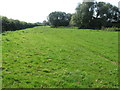
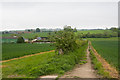
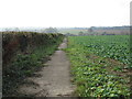
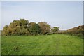
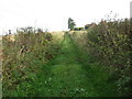
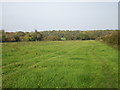
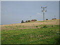
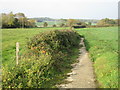
Photos of PO17 5BL


Area Information
Living in PO17 5BL means residing within a compact residential cluster defined by postcode PO17 5BL in Hampshire. This specific area covers 43.2 hectares, creating a contained environment where the population stands at 1,492 residents. With a population density of 228 people per square kilometre, the location maintains a quiet character rather than sprawling across broad distances. The postal code area functions as a distinct suburb where daily life revolves around close-knit neighbourhoods and manageable commuting distances. Prospective buyers will find that PO17 5BL offers a settled atmosphere, ideal for those who prefer a less congested environment compared to larger urban centres. The geographic specifics of this postcode ensure that residents enjoy a defined sense of place while remaining connected to wider regional networks. Understanding the scale of PO17 5BL helps set expectations for local services and community interactions, as the area size directly influences the availability of extensive local facilities within immediate walking distance.
- Area Type
- Postcode
- Area Size
- 43.2 hectares
- Population
- 1492
- Population Density
- 228 people/km²
The housing market within PO17 5BL is characterised by an overwhelmingly owner-occupied sector, as 84 percent of homes are held by their occupants. The predominant accommodation type consists of houses, meaning buyers seeking flats or apartments will find limited inventory within this specific cluster. This high rate of home ownership indicates a stable market where long-term residents are the primary buyers and sellers. Families looking for semi-detached or detached properties will find the stock of PO17 5BL well-matched to their requirements, given the dominance of house types. The lack of rental dominance suggests that the area attracts those seeking to settle permanently rather than temporary tenants. When evaluating homes in PO17 5BL, you can expect a consistent standard of property maintenance driven by owner investment. The small size of the area, covering only 43.2 hectares, further limits the variety of building styles, creating a homogenous market focused on traditional housing. This consistency benefits buyers who prefer established neighbourhoods with predictable property values and architectural features.
House Prices in PO17 5BL
Showing 4 properties
| Address | Type | Beds | Baths | Last Sale Price | Last Sale Date | |
|---|---|---|---|---|---|---|
| Ground Floor Staff Flat, Roche Court, Wickham Road, Fareham, PO17 5BL | Flat | - | - | - | - | |
| The Flat, Roche Court, Wickham Road, Fareham, PO17 5BL | Flat | - | - | - | - | |
| First Floor Staff Flat, Roche Court, Wickham Road, Fareham, PO17 5BL | Flat | - | - | - | - | |
| Boundary Oak School Residential Accommodation, Roche Court, Wickham Road, Fareham, PO17 5BL | Flat | - | - | - | - |
Energy Efficiency in PO17 5BL
Daily life in PO17 5BL benefits from a diverse range of nearby amenities within practical reach. Residents have access to five retail options including Sainsburys Broadcut, Spar, and Morrisons Daily Fareham 107 for grocery and general shopping needs. Transport connectivity is supported by five rail stations nearby, such as Fareham Railway Station, Portchester Railway Station, and Swanwick Railway Station, facilitating easy regional travel. Additionally, five ferry terminals provide alternative transport links, with notable sites including Portsmouth International Cruise and Ferry Terminal, Gosport Ferry Terminal, and Portsmouth Harbour Station Pier. These amenities create a convenient network for commuting, leisure travel, and everyday errands. The presence of major supermarkets ensures fresh food and household essentials are available locally, reducing the need for daily long drives. Access to multiple railway and ferry hubs gives residents flexibility when choosing how to reach Portsmouth, Southampton, or other coastal destinations. This blend of retail and transit options means that living in PO17 5BL allows for a balance between a quiet home environment and an active social life accessible by public transport.
Amenities
Schools
Families looking for schools near PO17 5BL have access to specific educational institutions within practical reach. The primary option listed for this postcode area is Boundary Oak School, which operates as an independent school. This institution offers an alternative to state-funded primary or secondary education for parents seeking specialised curricula or smaller class sizes. The presence of Boundary Oak School highlights that this neighbourhood caters to families with the means to utilise independent education pathways. While further quantitative data on exam results or attendance figures are not provided in the current dataset, the existence of this named facility establishes a clear educational provision for the area. Parents residing in PO17 5BL do not rely on distant schools for the initial stages of their children's development as they have this local unabhängige option. The independent nature of the school suggests a private fee structure, which aligns with the high home ownership rates observed in the community. When planning your education route for PO17 5BL, consider how this single named facility fits alongside any commuting requirements to larger town centres.
| Rank | School | Type | Entry gender | Ages |
|---|
Explore more schools in this area
Go to Schools tabDemographics
The community in PO17 5BL reflects a mature demographic profile with a median age of 47 years. Most common are adults aged between 30 and 64 years, indicating a population established in their careers and families. Home ownership is notably high, with 84 percent of residents owning their properties outright or with a mortgage. This statistic aligns with the fact that the predominant accommodation type consists of houses, confirming this is a traditional family-oriented zone. The most predominant ethnic group is White, matching the regional and national demographic patterns typical of this specific postcode area. There is no significant data indicating high levels of deprivation or economic disadvantage within the measured parameters of PO17 5BL. Home ownership levels suggest financial stability among the majority of households, which often correlates with better maintained housing stock and longer-term community investments. The age distribution supports a stable environment where long-term residents form the backbone of the local social scene.
Household Size
Accommodation Type
Tenure
Ethnic Group
Religion
Household Composition
Age
Household Deprivation
NS-SEC
Explore more demographic insights in this area
Go to Demographics tabPlanning
Planning Constraints
- Flood RiskPremium
- Ramsar Wetland SitesPremium
- Area of Outstanding Natural BeautyPremium
- Protected Nature ReservePremium
- Protected WoodlandPremium