Area Overview for PO17 5AY
Photos of PO17 5AY
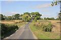


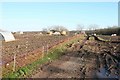
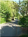
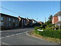
7 photos from this area
Area Information
Key information about the PO17 5AY including its size, population, and administrative classification.
- Area Type
- Postcode
- Area Size
- 79.9 hectares
- Population
- 1607
- Population Density
- 286 people/km²
House Prices in PO17 5AY
16
Properties
£572,500
Average Sold Price
£425,000
Lowest Price
£720,000
Highest Price
Showing 16 properties
| Address | Type | Beds | Baths | Last Sale Price | Last Sale Date | |
|---|---|---|---|---|---|---|
| Green Glades, Droxford Road, Wickham, PO17 5AY | Bungalow | 5 | 3 | £720,000 | Jun 2014 | |
| Woodlands Cottage, Droxford Road, Wickham, PO17 5AY | Detached | - | - | £425,000 | Dec 2000 | |
| The Flat, The Roebuck Inn, Droxford Road, Wickham, PO17 5AY | Flat | - | - | - | - | |
| Tennis 30M From Mayfield, Droxford Road 18M From Unnamed Road, Droxford Road, Wickham, PO17 5AY | Leisure | - | - | - | - | |
| The Chalet, Meon Valley Garage, Droxford Road, Wickham, PO17 5AY | Detached | - | - | - | - | |
| Unit 9, Meon Valley Garage, Droxford Road, Wickham, PO17 5AY | Industrial | - | - | - | - | |
| Unit 1, Meon Valley Garage, Droxford Road, Wickham, PO17 5AY | Industrial | - | - | - | - | |
| The Flat, Meon Valley Garage, Droxford Road, Wickham, PO17 5AY | Flat | - | - | - | - | |
| Roebuck Inn, Droxford Road, Wickham, PO17 5AY | restaurant_cafe | - | - | - | - | |
| Forest View Mobile Home, Meon Valley Garage, Droxford Road, Wickham, PO17 5AY | Mobile Home | - | - | - | - |
Page 1 of 2
Energy Efficiency in PO17 5AY
Amenities
Schools
| Rank | School | Type | Entry gender | Ages |
|---|
Explore more schools in this area
Go to Schools tabDemographics
Household Size
One person
most common
Accommodation Type
Houses
most common
Tenure
56
majority
Ethnic Group
White
most common
Religion
N/A
most common
Household Composition
N/A
most common
Age
47
median
Adults (30-64 years)
most common
Household Deprivation
N/A
with no deprivation
NS-SEC
33
in Lower managerial occupations
Explore more demographic insights in this area
Go to Demographics tabPlanning
Planning Constraints
- Flood RiskPremium
- Ramsar Wetland SitesPremium
- Area of Outstanding Natural BeautyPremium
- Protected Nature ReservePremium
- Protected WoodlandPremium