Area Overview for PO17 5AD
Photos of PO17 5AD
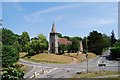
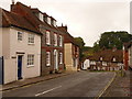
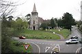
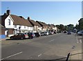
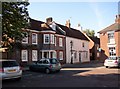
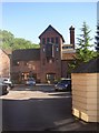
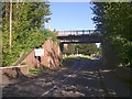
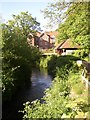
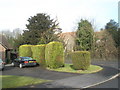
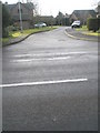
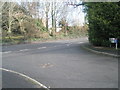
100 photos from this area
Area Information
Key information about the PO17 5AD including its size, population, and administrative classification.
- Area Type
- Postcode
- Area Size
- 2.7 hectares
- Population
- 1345
- Population Density
- 168 people/km²
House Prices in PO17 5AD
39
Properties
£208,459
Average Sold Price
£49,000
Lowest Price
£338,000
Highest Price
Showing 39 properties
| Address | Type | Beds | Baths | Last Sale Price | Last Sale Date | |
|---|---|---|---|---|---|---|
| 48 Wykeham Field, Wickham, PO17 5AD | Terraced | 3 | 2 | £338,000 | Mar 2025 | |
| 43 Wykeham Field, Wickham, PO17 5AD | Terraced | 3 | 1 | £330,000 | Aug 2024 | |
| 55 Wykeham Field, Wickham, PO17 5AD | Terraced | 3 | 1 | £275,000 | Nov 2023 | |
| 67 Wykeham Field, Wickham, PO17 5AD | house | - | - | £300,000 | Sep 2022 | |
| 53 Wykeham Field, Wickham, PO17 5AD | Terraced | 3 | 1 | £268,000 | Mar 2020 | |
| 52 Wykeham Field, Wickham, PO17 5AD | house | - | - | £240,000 | Oct 2016 | |
| 56 Wykeham Field, Wickham, PO17 5AD | Terraced | 3 | 1 | £185,500 | Jan 2014 | |
| 41 Wykeham Field, Wickham, PO17 5AD | Terraced | 3 | 2 | £192,000 | Jun 2011 | |
| 66 Wykeham Field, Wickham, PO17 5AD | house | 2 | - | £145,000 | Jun 2009 | |
| 54 Wykeham Field, Wickham, PO17 5AD | Terraced | 3 | 2 | £190,000 | Nov 2007 |
Page 1 of 4
Energy Efficiency in PO17 5AD
Amenities
Schools
| Rank | School | Type | Entry gender | Ages |
|---|
Explore more schools in this area
Go to Schools tabDemographics
Household Size
Two person
most common
Accommodation Type
Houses
most common
Tenure
73
majority
Ethnic Group
White
most common
Religion
N/A
most common
Household Composition
N/A
most common
Age
47
median
Adults (30-64 years)
most common
Household Deprivation
N/A
with no deprivation
NS-SEC
43
in Lower managerial occupations
Explore more demographic insights in this area
Go to Demographics tabPlanning
Planning Constraints
- Flood RiskPremium
- Ramsar Wetland SitesPremium
- Area of Outstanding Natural BeautyPremium
- Protected Nature ReservePremium
- Protected WoodlandPremium