Area Overview for PO16 8UG
Photos of PO16 8UG
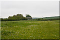
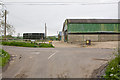
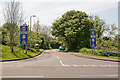

46 photos from this area
Area Information
Key information about the PO16 8UG including its size, population, and administrative classification.
- Area Type
- Postcode
- Area Size
- 1.2 hectares
- Population
- 1492
- Population Density
- 228 people/km²
House Prices in PO16 8UG
14
Properties
£326,045
Average Sold Price
£102,000
Lowest Price
£590,000
Highest Price
Showing 14 properties
| Address | Type | Beds | Baths | Last Sale Price | Last Sale Date | |
|---|---|---|---|---|---|---|
| 72 Furzehall Avenue, Fareham, PO16 8UG | Detached | 4 | 2 | £590,000 | Jun 2025 | |
| 70 Furzehall Avenue, Fareham, PO16 8UG | Detached | 4 | 2 | £500,000 | Dec 2024 | |
| 68 Furzehall Avenue, Fareham, PO16 8UG | house | 4 | - | £473,000 | Jun 2021 | |
| 85 Furzehall Avenue, Fareham, PO16 8UG | house | - | - | £404,000 | Sep 2016 | |
| 76 Furzehall Avenue, Fareham, PO16 8UG | Detached | 4 | 2 | £405,000 | Aug 2015 | |
| 83 Furzehall Avenue, Fareham, PO16 8UG | house | 4 | - | £280,000 | Dec 2009 | |
| 74 Furzehall Avenue, Fareham, PO16 8UG | house | - | - | £325,000 | Oct 2009 | |
| 81 Furzehall Avenue, Fareham, PO16 8UG | Detached | 4 | - | £247,000 | Aug 2003 | |
| 66 Furzehall Avenue, Fareham, PO16 8UG | Detached | - | - | £138,000 | Oct 1999 | |
| 87 Furzehall Avenue, Fareham, PO16 8UG | Detached | - | - | £122,500 | Oct 1998 |
Page 1 of 2
Energy Efficiency in PO16 8UG
Amenities
Schools
| Rank | School | Type | Entry gender | Ages |
|---|
Explore more schools in this area
Go to Schools tabDemographics
Household Size
Two person
most common
Accommodation Type
Houses
most common
Tenure
84
majority
Ethnic Group
White
most common
Religion
N/A
most common
Household Composition
N/A
most common
Age
47
median
Adults (30-64 years)
most common
Household Deprivation
N/A
with no deprivation
NS-SEC
52
in Lower managerial occupations
Explore more demographic insights in this area
Go to Demographics tabPlanning
Planning Constraints
- Flood RiskPremium
- Ramsar Wetland SitesPremium
- Area of Outstanding Natural BeautyPremium
- Protected Nature ReservePremium
- Protected WoodlandPremium