Area Overview for PO16 8PH
Photos of PO16 8PH
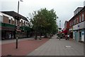

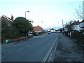
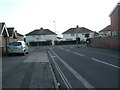
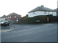


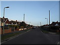
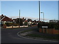
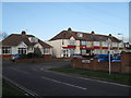
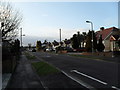

100 photos from this area
Area Information
Key information about the PO16 8PH including its size, population, and administrative classification.
- Area Type
- Postcode
- Area Size
- 2.2 hectares
- Population
- 1520
- Population Density
- 3310 people/km²
House Prices in PO16 8PH
48
Properties
£224,436
Average Sold Price
£53,000
Lowest Price
£570,000
Highest Price
Showing 48 properties
| Address | Type | Beds | Baths | Last Sale Price | Last Sale Date | |
|---|---|---|---|---|---|---|
| 27 The Leaway, Portchester, Fareham, PO16 8PH | Semi-detached | 4 | 3 | £465,000 | Oct 2025 | |
| 31 The Leaway, Portchester, Fareham, PO16 8PH | Semi-detached | 2 | 1 | £379,995 | Oct 2025 | |
| 28 The Leaway, Portchester, Fareham, PO16 8PH | Bungalow | - | - | £280,000 | Mar 2025 | |
| 1 The Leaway, Portchester, Fareham, PO16 8PH | Bungalow | 3 | 2 | £570,000 | Dec 2024 | |
| 35 The Leaway, Portchester, Fareham, PO16 8PH | Semi-detached | 2 | 1 | £275,000 | Nov 2024 | |
| 7 The Leaway, Portchester, Fareham, PO16 8PH | Semi-detached | 2 | 1 | £315,000 | Jul 2024 | |
| 6 The Leaway, Portchester, Fareham, PO16 8PH | Semi-detached | 2 | 1 | £285,000 | Mar 2024 | |
| 16 The Leaway, Portchester, Fareham, PO16 8PH | Bungalow | 2 | - | £186,000 | Jan 2024 | |
| 2 The Leaway, Portchester, Fareham, PO16 8PH | Bungalow | 2 | 1 | £305,000 | Oct 2022 | |
| 55 The Leaway, Portchester, Fareham, PO16 8PH | Bungalow | - | - | £275,500 | Sep 2021 |
Page 1 of 5
Energy Efficiency in PO16 8PH
Amenities
Schools
| Rank | School | Type | Entry gender | Ages |
|---|
Explore more schools in this area
Go to Schools tabDemographics
Household Size
Two person
most common
Accommodation Type
Houses
most common
Tenure
74
majority
Ethnic Group
White
most common
Religion
N/A
most common
Household Composition
N/A
most common
Age
47
median
Adults (30-64 years)
most common
Household Deprivation
N/A
with no deprivation
NS-SEC
33
in Lower managerial occupations
Explore more demographic insights in this area
Go to Demographics tabPlanning
Planning Constraints
- Flood RiskPremium
- Ramsar Wetland SitesPremium
- Area of Outstanding Natural BeautyPremium
- Protected Nature ReservePremium
- Protected WoodlandPremium