Area Overview for PO16 8DN
Photos of PO16 8DN
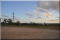

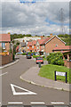
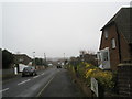
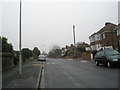
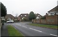
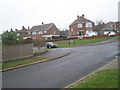

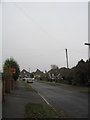
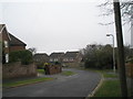
100 photos from this area
Area Information
Key information about the PO16 8DN including its size, population, and administrative classification.
- Area Type
- Postcode
- Area Size
- 1.1 hectares
- Population
- 1281
- Population Density
- 5331 people/km²
House Prices in PO16 8DN
33
Properties
£216,752
Average Sold Price
£74,000
Lowest Price
£400,000
Highest Price
Showing 33 properties
| Address | Type | Beds | Baths | Last Sale Price | Last Sale Date | |
|---|---|---|---|---|---|---|
| 31 Froxfield Gardens, Portchester, Fareham, PO16 8DN | house | 4 | 2 | £345,000 | Feb 2025 | |
| 24 Froxfield Gardens, Portchester, Fareham, PO16 8DN | Retail | 3 | 1 | £342,000 | May 2022 | |
| 8 Froxfield Gardens, Portchester, Fareham, PO16 8DN | house | - | - | £400,000 | Dec 2021 | |
| 14 Froxfield Gardens, Portchester, Fareham, PO16 8DN | Semi-detached | 3 | 1 | £252,500 | Feb 2019 | |
| 23 Froxfield Gardens, Portchester, Fareham, PO16 8DN | Semi-detached | 3 | - | £280,000 | Aug 2017 | |
| 7 Froxfield Gardens, Portchester, Fareham, PO16 8DN | house | 4 | - | £340,000 | Dec 2015 | |
| 10 Froxfield Gardens, Portchester, Fareham, PO16 8DN | Semi-detached | 3 | - | £249,995 | Nov 2015 | |
| 5 Froxfield Gardens, Portchester, Fareham, PO16 8DN | Detached | - | - | £263,000 | Nov 2014 | |
| 18 Froxfield Gardens, Portchester, Fareham, PO16 8DN | house | - | - | £245,000 | Aug 2011 | |
| 12 Froxfield Gardens, Portchester, Fareham, PO16 8DN | house | - | - | £167,000 | May 2009 |
Page 1 of 4
Energy Efficiency in PO16 8DN
Amenities
Schools
| Rank | School | Type | Entry gender | Ages |
|---|
Explore more schools in this area
Go to Schools tabDemographics
Household Size
Family (3-5 people)
most common
Accommodation Type
Houses
most common
Tenure
87
majority
Ethnic Group
White
most common
Religion
N/A
most common
Household Composition
N/A
most common
Age
47
median
Adults (30-64 years)
most common
Household Deprivation
N/A
with no deprivation
NS-SEC
40
in Lower managerial occupations
Explore more demographic insights in this area
Go to Demographics tabPlanning
Planning Constraints
- Flood RiskPremium
- Ramsar Wetland SitesPremium
- Area of Outstanding Natural BeautyPremium
- Protected Nature ReservePremium
- Protected WoodlandPremium