Area Overview for PO16 8DH
Photos of PO16 8DH


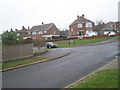

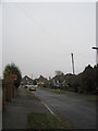
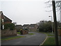
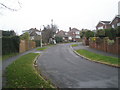
100 photos from this area
Area Information
Key information about the PO16 8DH including its size, population, and administrative classification.
- Area Type
- Postcode
- Area Size
- 9636 m²
- Population
- 1281
- Population Density
- 5331 people/km²
House Prices in PO16 8DH
20
Properties
£264,750
Average Sold Price
£123,000
Lowest Price
£440,000
Highest Price
Showing 20 properties
| Address | Type | Beds | Baths | Last Sale Price | Last Sale Date | |
|---|---|---|---|---|---|---|
| 46 Linden Lea, Portchester, Fareham, PO16 8DH | Semi-detached | 3 | 1 | £391,000 | Jul 2024 | |
| 53 Linden Lea, Portchester, Fareham, PO16 8DH | house | - | - | £338,000 | Jan 2023 | |
| 48 Linden Lea, Portchester, Fareham, PO16 8DH | house | - | - | £440,000 | Jun 2021 | |
| 40 Linden Lea, Portchester, Fareham, PO16 8DH | house | - | - | £335,000 | Oct 2020 | |
| 52 Linden Lea, Portchester, Fareham, PO16 8DH | Semi-detached | 3 | - | £330,000 | Feb 2018 | |
| 63 Linden Lea, Portchester, Fareham, PO16 8DH | Semi-detached | - | - | £264,000 | Nov 2015 | |
| 65 Linden Lea, Portchester, Fareham, PO16 8DH | Semi-detached | 4 | 2 | £263,000 | Dec 2014 | |
| 59 Linden Lea, Portchester, Fareham, PO16 8DH | house | - | - | £200,000 | Jun 2009 | |
| 69 Linden Lea, Portchester, Fareham, PO16 8DH | Semi-detached | - | - | £222,500 | May 2007 | |
| 49 Linden Lea, Portchester, Fareham, PO16 8DH | Semi-detached | - | - | £219,500 | Apr 2007 |
Page 1 of 2
Energy Efficiency in PO16 8DH
Amenities
Schools
| Rank | School | Type | Entry gender | Ages |
|---|
Explore more schools in this area
Go to Schools tabDemographics
Household Size
Family (3-5 people)
most common
Accommodation Type
Houses
most common
Tenure
87
majority
Ethnic Group
White
most common
Religion
N/A
most common
Household Composition
N/A
most common
Age
47
median
Adults (30-64 years)
most common
Household Deprivation
N/A
with no deprivation
NS-SEC
40
in Lower managerial occupations
Explore more demographic insights in this area
Go to Demographics tabPlanning
Planning Constraints
- Flood RiskPremium
- Ramsar Wetland SitesPremium
- Area of Outstanding Natural BeautyPremium
- Protected Nature ReservePremium
- Protected WoodlandPremium