Area Overview for PO16 7UL
Photos of PO16 7UL

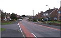


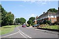
39 photos from this area
Area Information
Key information about the PO16 7UL including its size, population, and administrative classification.
- Area Type
- Postcode
- Area Size
- 8893 m²
- Population
- 1428
- Population Density
- 2803 people/km²
House Prices in PO16 7UL
11
Properties
£422,606
Average Sold Price
£123,950
Lowest Price
£610,000
Highest Price
Showing 11 properties
| Address | Type | Beds | Baths | Last Sale Price | Last Sale Date | |
|---|---|---|---|---|---|---|
| 87 Kiln Road, Fareham, PO16 7UL | Detached | 4 | 1 | £600,000 | Dec 2024 | |
| 83 Kiln Road, Fareham, PO16 7UL | Detached | 4 | 2 | £439,950 | Jun 2021 | |
| 81 Kiln Road, Fareham, PO16 7UL | house | - | - | £470,000 | Jan 2018 | |
| 91 Kiln Road, Fareham, PO16 7UL | house | - | - | £379,950 | Aug 2017 | |
| 85 Kiln Road, Fareham, PO16 7UL | Detached | 4 | 3 | £470,000 | Jul 2014 | |
| 77 Kiln Road, Fareham, PO16 7UL | Detached | 5 | 4 | £610,000 | Dec 2006 | |
| 89 Kiln Road, Fareham, PO16 7UL | Detached | - | - | £287,000 | Sep 2005 | |
| 79 Kiln Road, Fareham, PO16 7UL | Detached | - | - | £123,950 | May 1998 | |
| 77A Kiln Road, Fareham, PO16 7UL | house | - | - | - | - | |
| 77B Kiln Road, Fareham, PO16 7UL | Detached | - | - | - | - |
Page 1 of 2
Energy Efficiency in PO16 7UL
Amenities
Schools
| Rank | School | Type | Entry gender | Ages |
|---|
Explore more schools in this area
Go to Schools tabDemographics
Household Size
Two person
most common
Accommodation Type
Houses
most common
Tenure
89
majority
Ethnic Group
White
most common
Religion
N/A
most common
Household Composition
N/A
most common
Age
47
median
Adults (30-64 years)
most common
Household Deprivation
N/A
with no deprivation
NS-SEC
47
in Lower managerial occupations
Explore more demographic insights in this area
Go to Demographics tabPlanning
Planning Constraints
- Flood RiskPremium
- Ramsar Wetland SitesPremium
- Area of Outstanding Natural BeautyPremium
- Protected Nature ReservePremium
- Protected WoodlandPremium