Area Overview for PO15 6SH
Photos of PO15 6SH
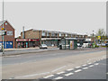
70 photos from this area
Area Information
Key information about the PO15 6SH including its size, population, and administrative classification.
- Area Type
- Postcode
- Area Size
- 1.2 hectares
- Population
- 1454
- Population Density
- 1921 people/km²
House Prices in PO15 6SH
33
Properties
£142,303
Average Sold Price
£50,000
Lowest Price
£330,000
Highest Price
Showing 33 properties
| Address | Type | Beds | Baths | Last Sale Price | Last Sale Date | |
|---|---|---|---|---|---|---|
| 118 Privett Road, Fareham, PO15 6SH | Terraced | 3 | 1 | £250,000 | Oct 2025 | |
| 120 Privett Road, Fareham, PO15 6SH | Terraced | 3 | 1 | £219,263 | Jul 2025 | |
| 88A Privett Road, Fareham, PO15 6SH | Terraced | 3 | 1 | £330,000 | Apr 2024 | |
| 124 Privett Road, Fareham, PO15 6SH | Terraced | 3 | 1 | £243,000 | Nov 2023 | |
| 88 Privett Road, Fareham, PO15 6SH | Terraced | 2 | 1 | £224,000 | Aug 2020 | |
| 130 Privett Road, Fareham, PO15 6SH | Terraced | 3 | - | £150,000 | Mar 2015 | |
| 106 Privett Road, Fareham, PO15 6SH | Terraced | 3 | - | £166,000 | Nov 2014 | |
| 90 Privett Road, Fareham, PO15 6SH | house | - | - | £139,000 | Dec 2013 | |
| 114 Privett Road, Fareham, PO15 6SH | house | 3 | - | £116,500 | Feb 2012 | |
| 74 Privett Road, Fareham, PO15 6SH | house | 4 | 1 | £125,000 | Mar 2011 |
Page 1 of 4
Energy Efficiency in PO15 6SH
Amenities
Schools
| Rank | School | Type | Entry gender | Ages |
|---|
Explore more schools in this area
Go to Schools tabDemographics
Household Size
Family (3-5 people)
most common
Accommodation Type
Houses
most common
Tenure
46
majority
Ethnic Group
White
most common
Religion
N/A
most common
Household Composition
N/A
most common
Age
47
median
Adults (30-64 years)
most common
Household Deprivation
N/A
with no deprivation
NS-SEC
23
in Lower managerial occupations
Explore more demographic insights in this area
Go to Demographics tabPlanning
Planning Constraints
- Flood RiskPremium
- Ramsar Wetland SitesPremium
- Area of Outstanding Natural BeautyPremium
- Protected Nature ReservePremium
- Protected WoodlandPremium