Area Overview for PO15 6LJ
Photos of PO15 6LJ
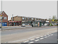

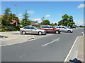
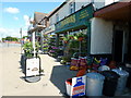
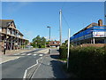
70 photos from this area
Area Information
Key information about the PO15 6LJ including its size, population, and administrative classification.
- Area Type
- Postcode
- Area Size
- 6843 m²
- Population
- 1493
- Population Density
- 3493 people/km²
House Prices in PO15 6LJ
15
Properties
£261,727
Average Sold Price
£114,000
Lowest Price
£375,000
Highest Price
Showing 15 properties
| Address | Type | Beds | Baths | Last Sale Price | Last Sale Date | |
|---|---|---|---|---|---|---|
| 64 Fareham Park Road, Fareham, PO15 6LJ | Bungalow | 2 | 1 | £375,000 | Mar 2024 | |
| 66 Fareham Park Road, Fareham, PO15 6LJ | Bungalow | - | - | £365,000 | Apr 2021 | |
| 91 Fareham Park Road, Fareham, PO15 6LJ | Bungalow | - | - | £300,000 | Dec 2020 | |
| 97 Fareham Park Road, Fareham, PO15 6LJ | Semi-detached | 3 | 1 | £275,000 | Aug 2018 | |
| 99 Fareham Park Road, Fareham, PO15 6LJ | house | - | - | £260,000 | May 2018 | |
| 93 Fareham Park Road, Fareham, PO15 6LJ | Bungalow | 3 | - | £350,000 | Jan 2018 | |
| 64A Fareham Park Road, Fareham, PO15 6LJ | Bungalow | 2 | 1 | £350,000 | Dec 2017 | |
| 89 Fareham Park Road, Fareham, PO15 6LJ | Bungalow | 3 | - | £173,000 | Feb 2012 | |
| 83 Fareham Park Road, Fareham, PO15 6LJ | Semi-detached | - | - | £155,000 | Jun 2005 | |
| 79 Fareham Park Road, Fareham, PO15 6LJ | house | - | - | £162,000 | Sep 2003 |
Page 1 of 2
Energy Efficiency in PO15 6LJ
Amenities
Schools
| Rank | School | Type | Entry gender | Ages |
|---|
Explore more schools in this area
Go to Schools tabDemographics
Household Size
Two person
most common
Accommodation Type
Houses
most common
Tenure
86
majority
Ethnic Group
White
most common
Religion
N/A
most common
Household Composition
N/A
most common
Age
47
median
Adults (30-64 years)
most common
Household Deprivation
N/A
with no deprivation
NS-SEC
35
in Lower managerial occupations
Explore more demographic insights in this area
Go to Demographics tabPlanning
Planning Constraints
- Flood RiskPremium
- Ramsar Wetland SitesPremium
- Area of Outstanding Natural BeautyPremium
- Protected Nature ReservePremium
- Protected WoodlandPremium