Area Overview for PO15 6AQ
Photos of PO15 6AQ


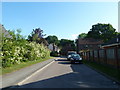
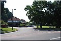
39 photos from this area
Area Information
Key information about the PO15 6AQ including its size, population, and administrative classification.
- Area Type
- Postcode
- Area Size
- 8816 m²
- Population
- 1643
- Population Density
- 4660 people/km²
House Prices in PO15 6AQ
17
Properties
£252,318
Average Sold Price
£175,000
Lowest Price
£350,000
Highest Price
Showing 17 properties
| Address | Type | Beds | Baths | Last Sale Price | Last Sale Date | |
|---|---|---|---|---|---|---|
| 45 Frosthole Crescent, Fareham, PO15 6AQ | Bungalow | 2 | 1 | £350,000 | Jun 2024 | |
| 47 Frosthole Crescent, Fareham, PO15 6AQ | Bungalow | - | - | £350,000 | Oct 2023 | |
| 41 Frosthole Crescent, Fareham, PO15 6AQ | Bungalow | 2 | 1 | £265,000 | Dec 2019 | |
| 33 Frosthole Crescent, Fareham, PO15 6AQ | Bungalow | 2 | 1 | £276,000 | May 2019 | |
| 30 Frosthole Crescent, Fareham, PO15 6AQ | Bungalow | - | - | £300,000 | Jul 2017 | |
| 36 Frosthole Crescent, Fareham, PO15 6AQ | Bungalow | 3 | - | £250,000 | Sep 2014 | |
| 49 Frosthole Crescent, Fareham, PO15 6AQ | Bungalow | 3 | - | £225,000 | Jun 2013 | |
| 39 Frosthole Crescent, Fareham, PO15 6AQ | Bungalow | 2 | - | £185,000 | Feb 2010 | |
| 37 Frosthole Crescent, Fareham, PO15 6AQ | Detached | - | - | £197,500 | Sep 2008 | |
| 32 Frosthole Crescent, Fareham, PO15 6AQ | Bungalow | - | - | £202,000 | Dec 2005 |
Page 1 of 2
Energy Efficiency in PO15 6AQ
Amenities
Schools
| Rank | School | Type | Entry gender | Ages |
|---|
Explore more schools in this area
Go to Schools tabDemographics
Household Size
Two person
most common
Accommodation Type
Houses
most common
Tenure
72
majority
Ethnic Group
White
most common
Religion
N/A
most common
Household Composition
N/A
most common
Age
47
median
Adults (30-64 years)
most common
Household Deprivation
N/A
with no deprivation
NS-SEC
37
in Lower managerial occupations
Explore more demographic insights in this area
Go to Demographics tabPlanning
Planning Constraints
- Flood RiskPremium
- Ramsar Wetland SitesPremium
- Area of Outstanding Natural BeautyPremium
- Protected Nature ReservePremium
- Protected WoodlandPremium