Area Overview for PO14 3SY
Photos of PO14 3SY
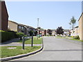
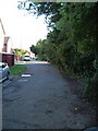
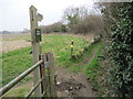
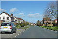
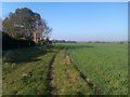
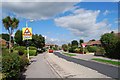
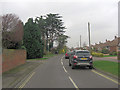
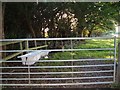
8 photos from this area
Area Information
Key information about the PO14 3SY including its size, population, and administrative classification.
- Area Type
- Postcode
- Area Size
- 9715 m²
- Population
- 1375
- Population Density
- 4872 people/km²
House Prices in PO14 3SY
40
Properties
£185,668
Average Sold Price
£36,500
Lowest Price
£340,000
Highest Price
Showing 40 properties
| Address | Type | Beds | Baths | Last Sale Price | Last Sale Date | |
|---|---|---|---|---|---|---|
| 50 The Gannets, Fareham, PO14 3SY | Flat | - | - | £180,000 | Dec 2025 | |
| 34 The Gannets, Fareham, PO14 3SY | Bungalow | 2 | 1 | £237,000 | Oct 2025 | |
| 50A The Gannets, Fareham, PO14 3SY | Flat | 1 | 1 | £170,000 | Mar 2025 | |
| 16 The Gannets, Fareham, PO14 3SY | house | 3 | 1 | £272,500 | Jan 2025 | |
| 3 The Gannets, Fareham, PO14 3SY | Semi-detached | 2 | 1 | £275,500 | Jan 2024 | |
| 10 The Gannets, Fareham, PO14 3SY | Terraced | 3 | 1 | £302,500 | Jul 2023 | |
| 6 The Gannets, Fareham, PO14 3SY | Semi-detached | 3 | 1 | £340,000 | Apr 2022 | |
| 19 The Gannets, Fareham, PO14 3SY | house | - | - | £325,000 | Feb 2022 | |
| 14 The Gannets, Fareham, PO14 3SY | Terraced | 3 | 1 | £250,000 | Apr 2018 | |
| 2 The Gannets, Fareham, PO14 3SY | Semi-detached | 3 | 1 | £285,000 | Dec 2017 |
Page 1 of 4
Energy Efficiency in PO14 3SY
Amenities
Schools
| Rank | School | Type | Entry gender | Ages |
|---|
Explore more schools in this area
Go to Schools tabDemographics
Household Size
Two person
most common
Accommodation Type
Houses
most common
Tenure
83
majority
Ethnic Group
White
most common
Religion
N/A
most common
Household Composition
N/A
most common
Age
47
median
Adults (30-64 years)
most common
Household Deprivation
N/A
with no deprivation
NS-SEC
40
in Lower managerial occupations
Explore more demographic insights in this area
Go to Demographics tabPlanning
Planning Constraints
- Flood RiskPremium
- Ramsar Wetland SitesPremium
- Area of Outstanding Natural BeautyPremium
- Protected Nature ReservePremium
- Protected WoodlandPremium