Area Overview for PO14 3AH
Photos of PO14 3AH
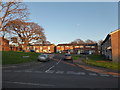
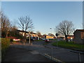
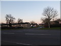
20 photos from this area
Area Information
Key information about the PO14 3AH including its size, population, and administrative classification.
- Area Type
- Postcode
- Area Size
- 1.2 hectares
- Population
- 1482
- Population Density
- 4933 people/km²
House Prices in PO14 3AH
34
Properties
£227,158
Average Sold Price
£61,500
Lowest Price
£335,000
Highest Price
Showing 34 properties
| Address | Type | Beds | Baths | Last Sale Price | Last Sale Date | |
|---|---|---|---|---|---|---|
| 33 Glenbrook Walk, Fareham, PO14 3AH | Semi-detached | 4 | 1 | £335,000 | Jul 2025 | |
| 12 Glenbrook Walk, Fareham, PO14 3AH | Semi-detached | 3 | 1 | £296,000 | May 2025 | |
| 7 Glenbrook Walk, Fareham, PO14 3AH | Semi-detached | 4 | 1 | £335,000 | Apr 2025 | |
| 6 Glenbrook Walk, Fareham, PO14 3AH | Semi-detached | 3 | 1 | £322,000 | Oct 2024 | |
| 23 Glenbrook Walk, Fareham, PO14 3AH | Semi-detached | 4 | 1 | £275,000 | Aug 2024 | |
| 26 Glenbrook Walk, Fareham, PO14 3AH | Semi-detached | 4 | 1 | £305,000 | May 2024 | |
| 14 Glenbrook Walk, Fareham, PO14 3AH | Retail | 3 | 1 | £330,000 | Oct 2022 | |
| 8 Glenbrook Walk, Fareham, PO14 3AH | Retail | 4 | 1 | £276,600 | Feb 2022 | |
| 25 Glenbrook Walk, Fareham, PO14 3AH | Detached | 4 | 1 | £325,000 | Dec 2021 | |
| 19 Glenbrook Walk, Fareham, PO14 3AH | house | - | - | £270,000 | Apr 2019 |
Page 1 of 4
Energy Efficiency in PO14 3AH
Amenities
Schools
| Rank | School | Type | Entry gender | Ages |
|---|
Explore more schools in this area
Go to Schools tabDemographics
Household Size
Family (3-5 people)
most common
Accommodation Type
Houses
most common
Tenure
60
majority
Ethnic Group
White
most common
Religion
N/A
most common
Household Composition
N/A
most common
Age
47
median
Adults (30-64 years)
most common
Household Deprivation
N/A
with no deprivation
NS-SEC
49
in Lower managerial occupations
Explore more demographic insights in this area
Go to Demographics tabPlanning
Planning Constraints
- Flood RiskPremium
- Ramsar Wetland SitesPremium
- Area of Outstanding Natural BeautyPremium
- Protected Nature ReservePremium
- Protected WoodlandPremium