Area Overview for PO14 2PN
Photos of PO14 2PN


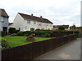


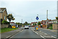
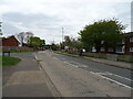
18 photos from this area
Area Information
Key information about the PO14 2PN including its size, population, and administrative classification.
- Area Type
- Postcode
- Area Size
- 7492 m²
- Population
- 1290
- Population Density
- 2839 people/km²
House Prices in PO14 2PN
9
Properties
£300,250
Average Sold Price
£154,000
Lowest Price
£448,000
Highest Price
Showing 9 properties
| Address | Type | Beds | Baths | Last Sale Price | Last Sale Date | |
|---|---|---|---|---|---|---|
| 47 Stubbington Lane, Fareham, PO14 2PN | Detached | 3 | 2 | £448,000 | Jun 2023 | |
| 43 Stubbington Lane, Fareham, PO14 2PN | Bungalow | 3 | 1 | £415,000 | Sep 2021 | |
| 39 Stubbington Lane, Fareham, PO14 2PN | Bungalow | 3 | - | £352,500 | Jan 2016 | |
| 41 Stubbington Lane, Fareham, PO14 2PN | Detached | 3 | 1 | £225,000 | Jun 2009 | |
| 49 Stubbington Lane, Fareham, PO14 2PN | Detached | - | - | £207,000 | Aug 2002 | |
| 45 Stubbington Lane, Fareham, PO14 2PN | Detached | - | - | £154,000 | Mar 2001 | |
| Spar Euro Garage, 33 Stubbington Lane, Fareham, PO14 2PN | shop | - | - | - | - | |
| Atm, Petrol Filling Station, 33 Stubbington Lane, Fareham, PO14 2PN | Retail | - | - | - | - | |
| 51 Stubbington Lane, Fareham, PO14 2PN | Detached | - | - | - | - |
Energy Efficiency in PO14 2PN
Amenities
Schools
| Rank | School | Type | Entry gender | Ages |
|---|
Explore more schools in this area
Go to Schools tabDemographics
Household Size
Two person
most common
Accommodation Type
Houses
most common
Tenure
94
majority
Ethnic Group
White
most common
Religion
N/A
most common
Household Composition
N/A
most common
Age
47
median
Adults (30-64 years)
most common
Household Deprivation
N/A
with no deprivation
NS-SEC
48
in Lower managerial occupations
Explore more demographic insights in this area
Go to Demographics tabPlanning
Planning Constraints
- Flood RiskPremium
- Ramsar Wetland SitesPremium
- Area of Outstanding Natural BeautyPremium
- Protected Nature ReservePremium
- Protected WoodlandPremium