Area Overview for PO14 2BA
Photos of PO14 2BA
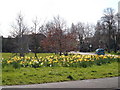
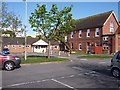
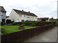
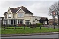

18 photos from this area
Area Information
Key information about the PO14 2BA including its size, population, and administrative classification.
- Area Type
- Postcode
- Area Size
- 3.2 hectares
- Population
- 1375
- Population Density
- 4872 people/km²
House Prices in PO14 2BA
22
Properties
£322,182
Average Sold Price
£79,400
Lowest Price
£545,000
Highest Price
Showing 22 properties
| Address | Type | Beds | Baths | Last Sale Price | Last Sale Date | |
|---|---|---|---|---|---|---|
| 4 Bells Lane, Fareham, PO14 2BA | Detached | 3 | 1 | £435,000 | Jun 2024 | |
| 5 Bells Lane, Fareham, PO14 2BA | Bungalow | 3 | 1 | £545,000 | Jan 2024 | |
| 2 Bells Lane, Fareham, PO14 2BA | Detached | 4 | 2 | £480,000 | Jun 2023 | |
| 7 Bells Lane, Fareham, PO14 2BA | Bungalow | 2 | 1 | £459,995 | Nov 2022 | |
| 19 Bells Lane, Fareham, PO14 2BA | Bungalow | - | - | £407,500 | Apr 2022 | |
| 9 Bells Lane, Fareham, PO14 2BA | Bungalow | - | - | £380,000 | Jan 2021 | |
| 23 Bells Lane, Fareham, PO14 2BA | Semi-detached | 3 | 1 | £435,000 | Aug 2020 | |
| 1 Bells Lane, Fareham, PO14 2BA | Semi-detached | 2 | 1 | £275,000 | Aug 2017 | |
| 25 Bells Lane, Fareham, PO14 2BA | Semi-detached | 3 | - | £308,950 | Nov 2015 | |
| 8 Bells Lane, Fareham, PO14 2BA | Detached | 3 | - | £395,300 | Aug 2015 |
Page 1 of 3
Energy Efficiency in PO14 2BA
Amenities
Schools
| Rank | School | Type | Entry gender | Ages |
|---|
Explore more schools in this area
Go to Schools tabDemographics
Household Size
Two person
most common
Accommodation Type
Houses
most common
Tenure
83
majority
Ethnic Group
White
most common
Religion
N/A
most common
Household Composition
N/A
most common
Age
47
median
Adults (30-64 years)
most common
Household Deprivation
N/A
with no deprivation
NS-SEC
40
in Lower managerial occupations
Explore more demographic insights in this area
Go to Demographics tabPlanning
Planning Constraints
- Flood RiskPremium
- Ramsar Wetland SitesPremium
- Area of Outstanding Natural BeautyPremium
- Protected Nature ReservePremium
- Protected WoodlandPremium