Area Overview for PO14 2AS
Photos of PO14 2AS
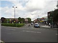
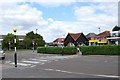
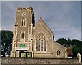
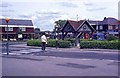
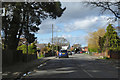
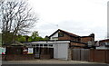
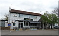
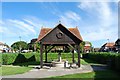


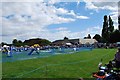
43 photos from this area
Area Information
Key information about the PO14 2AS including its size, population, and administrative classification.
- Area Type
- Postcode
- Area Size
- 2.2 hectares
- Population
- 1571
- Population Density
- 3376 people/km²
House Prices in PO14 2AS
15
Properties
£331,817
Average Sold Price
£135,000
Lowest Price
£530,000
Highest Price
Showing 15 properties
| Address | Type | Beds | Baths | Last Sale Price | Last Sale Date | |
|---|---|---|---|---|---|---|
| 9A Gosport Road, Stubbington, Fareham, PO14 2AS | Detached | 4 | 2 | £530,000 | Jul 2024 | |
| 27 Gosport Road, Stubbington, Fareham, PO14 2AS | house | 3 | 1 | £345,500 | May 2024 | |
| 29 Gosport Road, Stubbington, Fareham, PO14 2AS | Detached | 2 | 1 | £285,000 | May 2017 | |
| 9 Gosport Road, Stubbington, Fareham, PO14 2AS | house | - | - | £370,400 | Aug 2015 | |
| 25 Gosport Road, Stubbington, Fareham, PO14 2AS | Detached | - | - | £325,000 | Oct 2006 | |
| 11 Gosport Road, Stubbington, Fareham, PO14 2AS | Bungalow | 2 | 1 | £135,000 | Oct 1999 | |
| 1 Gosport Road, Stubbington, Fareham, PO14 2AS | Semi-detached | 3 | 1 | - | - | |
| 17 Gosport Road, Stubbington, Fareham, PO14 2AS | Semi-detached | - | - | - | - | |
| 3 Gosport Road, Stubbington, Fareham, PO14 2AS | Semi-detached | 2 | 1 | - | - | |
| 21 Gosport Road, Stubbington, Fareham, PO14 2AS | Detached | - | - | - | - |
Page 1 of 2
Energy Efficiency in PO14 2AS
Amenities
Schools
| Rank | School | Type | Entry gender | Ages |
|---|
Explore more schools in this area
Go to Schools tabDemographics
Household Size
One person
most common
Accommodation Type
Houses
most common
Tenure
75
majority
Ethnic Group
White
most common
Religion
N/A
most common
Household Composition
N/A
most common
Age
47
median
Elderly (65+ years)
most common
Household Deprivation
N/A
with no deprivation
NS-SEC
35
in Lower managerial occupations
Explore more demographic insights in this area
Go to Demographics tabPlanning
Planning Constraints
- Flood RiskPremium
- Ramsar Wetland SitesPremium
- Area of Outstanding Natural BeautyPremium
- Protected Nature ReservePremium
- Protected WoodlandPremium